MyTopo
Three Lakes Michigan US Topo Map
Couldn't load pickup availability
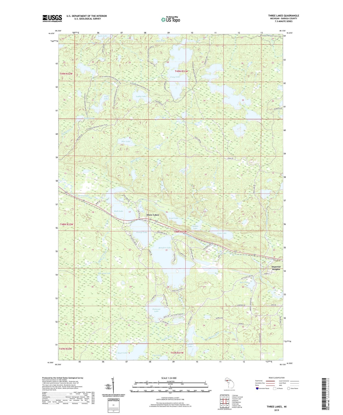
2023 topographic map quadrangle Three Lakes in the state of Michigan. Scale: 1:24000. Based on the newly updated USGS 7.5' US Topo map series, this map is in the following counties: Baraga. The map contains contour data, water features, and other items you are used to seeing on USGS maps, but also has updated roads and other features. This is the next generation of topographic maps. Printed on high-quality waterproof paper with UV fade-resistant inks.
Quads adjacent to this one:
West: Nestoria
Northwest: Herman
North: Mount Curwood
Northeast: Summit Lake
East: Michigamme
Southeast: Witch Lake NE
South: Nelson Lake
Southwest: Ned Lake
This map covers the same area as the classic USGS quad with code o46088e2.
Contains the following named places: Bass Lake, Beaufort Lake, Beaufort Lake State Forest Campground, Canal Town Creek, Coon Lake, Craig Lake, Craig Lake State Park, Crooked Lake, Deer Lake, George Lake, Heart Lake, Imperial Heights, Knight Lake, Long Lake, Middle Lake, Nelligan Creek, Nelligan Lake, Nestoria Creek, Ohio Mine, Pea Soup Lake, Petticoat Creek, Petticoat Lake, Redruth Post Office, Redruth Station, Ruth Lake, Spruce Lake, Spurr Mountain Post Office, Spurr Mountain Station, Spurr River, Teddy Lake, Three Lakes, Three Lakes Census Designated Place, Three Lakes Lookout Tower, Three Lakes Station, Township of Spurr, Trout Lake, Van Lake