MyTopo
Bessemer Michigan US Topo Map
Couldn't load pickup availability
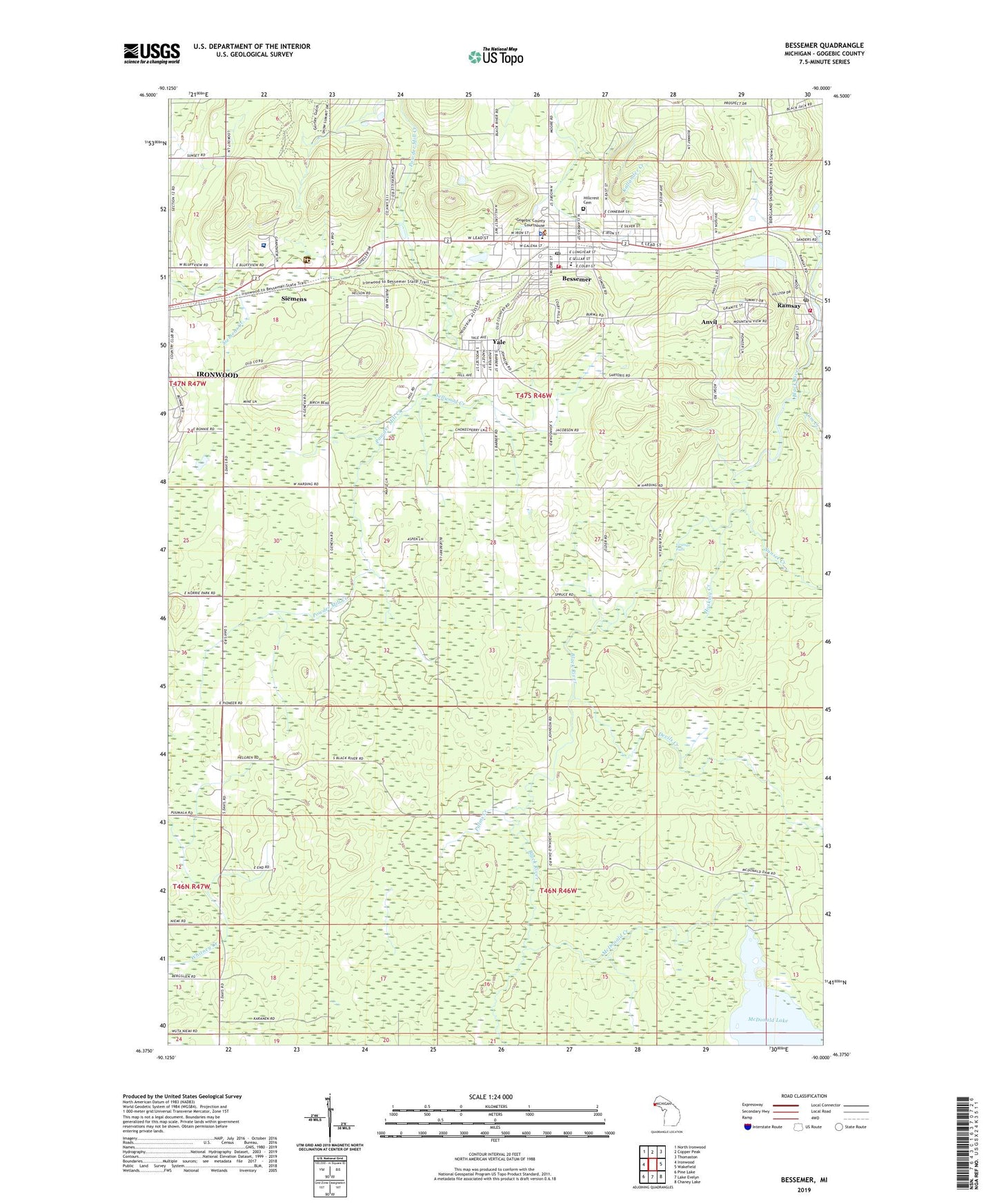
2023 topographic map quadrangle Bessemer in the state of Michigan. Scale: 1:24000. Based on the newly updated USGS 7.5' US Topo map series, this map is in the following counties: Gogebic. The map contains contour data, water features, and other items you are used to seeing on USGS maps, but also has updated roads and other features. This is the next generation of topographic maps. Printed on high-quality waterproof paper with UV fade-resistant inks.
Quads adjacent to this one:
West: Ironwood
Northwest: North Ironwood
North: Copper Peak
Northeast: Thomaston
East: Wakefield
Southeast: Chaney Lake
South: Lake Evelyn
Southwest: Pine Lake
This map covers the same area as the classic USGS quad with code o46090d1.
Contains the following named places: Alpine Trailer Park and Campground, Anvil, Anvil Location Post Office, Anvil Mine, Bessemer, Bessemer Fire Department, Bessemer Post Office, Bessemer Public Library, Bessemer Station, Bessemer Township Volunteer Fire Department, City of Bessemer, Cornerstone Christian Church, Devils Creek, Duluth Clinic, Geneva Mine, Gogebic Country Club, Gogebic County Courthouse, Gogebic County Sheriff's Office, Gogebic Iron Range Historical Marker, Grand View Clinic, Grand View Hospital, Granite Falls, Harding School, Hillcrest Cemetery, Hosking Creek, Johnston School, Keepers of the Faith Church, Living Water Missionary Church, Massie Field, McDonald Creek, McDonald Lake, Newport Mine, Old Colby Mine, Old Tilden Mine, Our Redeemer Lutheran Church, Palms Creek, Palms Mine, Peterson Mine, Puritan Post Office, Puritan School, Ramsay Post Office, Ramsay Station, Saint Sebastian Church, Sellwood Creek, Seventh-Day Adventist Church, Sharon Lutheran Church, Siemens, South Shore Orthopedics, Sunset Creek, Township of Erwin, Washington Elementary School, WUPM-FM (Ironwood), Yale, ZIP Code: 49911