MyTopo
Royston Michigan US Topo Map
Couldn't load pickup availability
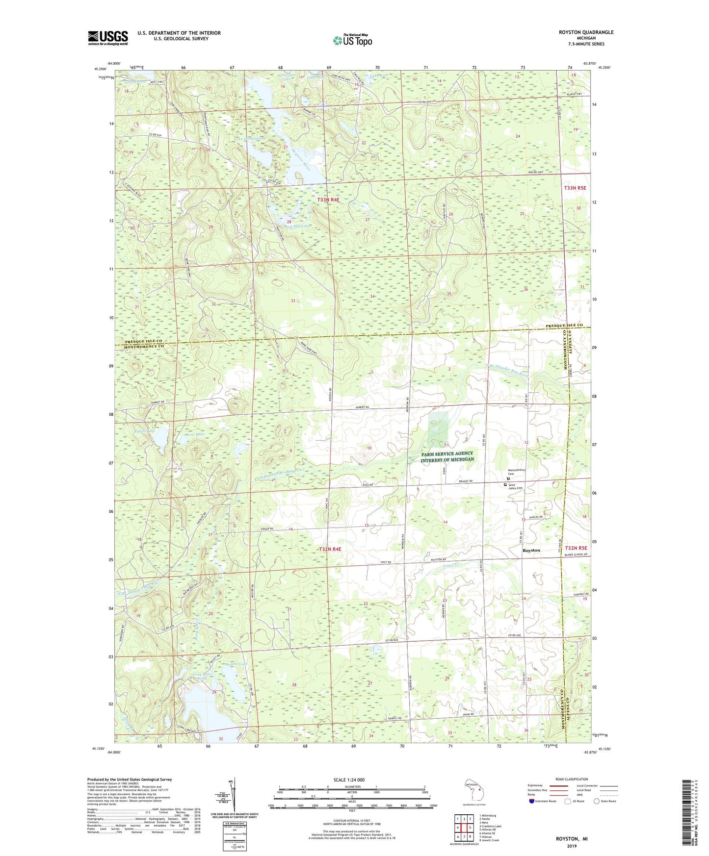
2019 topographic map quadrangle Royston in the state of Michigan. Scale: 1:24000. Based on the newly updated USGS 7.5' US Topo map series, this map is in the following counties: Montmorency, Presque Isle, Alpena. The map contains contour data, water features, and other items you are used to seeing on USGS maps, but also has updated roads and other features. This is the next generation of topographic maps. Printed on high-quality waterproof paper with UV fade-resistant inks.
Quads adjacent to this one:
West: Cranberry Lake
Northwest: Millersburg
North: Hawks
Northeast: Metz
East: Hillman NE
Southeast: Jewett Creek
South: Hillman
Southwest: Atlanta SE
Contains the following named places: Babcock School, Bedore Lake, Cement School, Grass Creek, Green School, Lake Emma Lookout Tower, Lake Ferdelman, Lake Paul, Lake Ruth, Long Lake, Long Lake Creek, Long Lake Pond, Lost Lake, Marl Bed Lake, Montmorency Cemetery, Quinn Creek, Ribble Lake, Royston, Royston Post Office, Saint John Lutheran Church, Saint Johns Cemetery, Saint Johns Church, Sportsmen Dam