MyTopo
Tallman Michigan US Topo Map
Couldn't load pickup availability
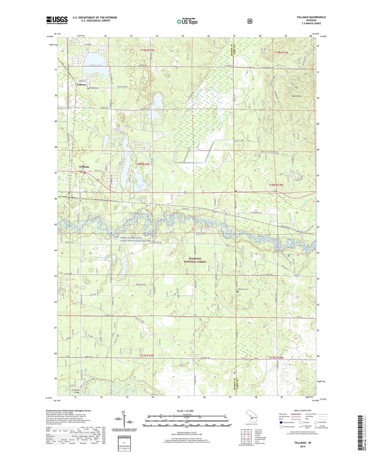
2019 topographic map quadrangle Tallman in the state of Michigan. Scale: 1:24000. Based on the newly updated USGS 7.5' US Topo map series, this map is in the following counties: Mason, Lake. The map contains contour data, water features, and other items you are used to seeing on USGS maps, but also has updated roads and other features. This is the next generation of topographic maps. Printed on high-quality waterproof paper with UV fade-resistant inks.
Quads adjacent to this one:
West: Custer
Northwest: Free Soil
North: Millerton
Northeast: Peacock
East: Townsend Lake
Southeast: Big Star Lake
South: Carr
Southwest: Crystal Valley
Contains the following named places: Branch, Branch Post Office, Branch Station, Branch Township Fire Department, Branch Township Hall, Campbell Bridge, Carr Creek, Carr Fire Department, Casin Lake, Dollar Lake, Emerson Lake, Gooseneck Lake, Juliet Lake, Lake School, Long Lake, Lower Branch Bridge Access, McPherson Cemetery, Pere Marquette Campground, Pere Marquette Wild and Scenic River, Romeo Lake, Tallman, Tallman Cemetery, Tallman Lake, Tallman Post Office, Tallman Station, Tank Creek, Township of Branch, Upper Branch Bridge Access, Walhalla, Walhalla Post Office, Walhalla Station, Ward Lake, Watassa Lake, ZIP Codes: 49402, 49458