MyTopo
Thomaston Michigan US Topo Map
Couldn't load pickup availability
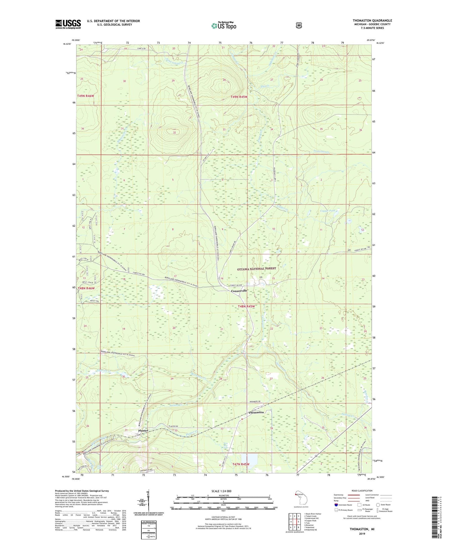
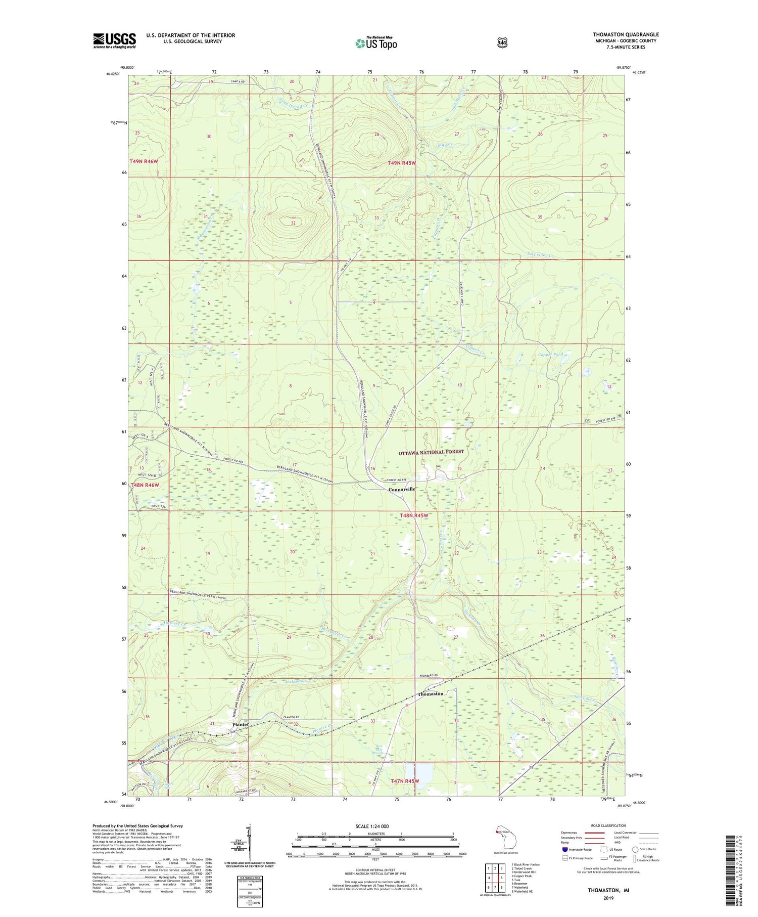
2019 topographic map quadrangle Thomaston in the state of Michigan. Scale: 1:24000. Based on the newly updated USGS 7.5' US Topo map series, this map is in the following counties: Gogebic. The map contains contour data, water features, and other items you are used to seeing on USGS maps, but also has updated roads and other features. This is the next generation of topographic maps. Printed on high-quality waterproof paper with UV fade-resistant inks.
Quads adjacent to this one:
West: Copper Peak
Northwest: Black River Harbor
North: Tiebel Creek
Northeast: Underwood Hill
East: Tula
Southeast: Wakefield NE
South: Wakefield
Southwest: Bessemer
Contains the following named places: Agogebic Ski Trail, Berranger Creek, Black Jack Ski Area, Bowden Creek, Broad Ax Ski Trail, Chippewa Ski Trail, Connor Creek, Connorville, Copper Pond, Crazy Horse Ski Trail, Crosscut Ski Trail, Deer Track Ski Trail, FIS Racing Ski Trail, Gabbro Falls, Geronimo Ski Trail, Gig Ski Trail, Grizzly Ski Trail, Hiawatha Ski Trail, Indianhead Mountain Ski Area, Jacks Cutoff Ski Trail, Jackson Creek, Leelinaw Ski Trail, Manley Siding, Narrow Gauge Ski Trail, Nastar Ski Trail, Nokomis Ski Trail, Old Flambeau Ski Trail, Ox Bow Ski Trail, Planter, Planter Creek, River Drive Ski Trail, Root Beer Falls, Running Bear Ski Trail, Shanty Boy Ski Trail, Shanty Girl Ski Trail, Spikehorn Creek, Stag Creek, Sundance Ski Trail, Thomaston, Thomaston Post Office, Thomaston Station, Thornapple Ski Trail, Tomahawk Ski Trail, Township of Wakefield, Turpeinen Creek, Voyagers Highway Ski Trail, Winnebago Ski Trail