MyTopo
West Branch Michigan US Topo Map
Couldn't load pickup availability
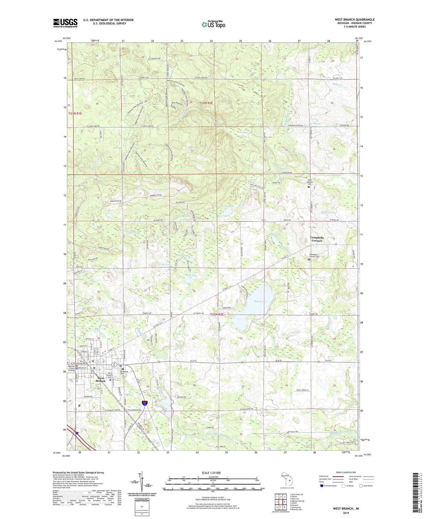
2023 topographic map quadrangle West Branch in the state of Michigan. Scale: 1:24000. Based on the newly updated USGS 7.5' US Topo map series, this map is in the following counties: Ogemaw. The map contains contour data, water features, and other items you are used to seeing on USGS maps, but also has updated roads and other features. This is the next generation of topographic maps. Printed on high-quality waterproof paper with UV fade-resistant inks.
Quads adjacent to this one:
West: Ogemaw Springs
Northwest: Saint Helen NE
North: Damon
Northeast: Rose City
East: Selkirk
Southeast: Skidway Lake
South: Sterling NW
Southwest: Edwards
This map covers the same area as the classic USGS quad with code o44084c2.
Contains the following named places: Apple Valley Golf Course, Baker College, Beulah Mission, Bortz Health Care - West Branch, Brewery Creek, Brookside Cemetery, Campbells Corners, Campbells Corners Cemetery, Campbells Corners Post Office, Cedar Lane Farms, Church of Christ, Church of God, Church of Jesus Christ of Latter Day Saints, Church of the Nazarene, City of West Branch, Community of Christ Church, Country Village Estates Mobile Home Park, Court Street Clinic, Crane Creek, Crapo Creek, Crapo Lake, Deer Lake, East Side School, Engle Pond, Evergreen Clinic, First United Methodist Church, Flowage Lake, Foose Swamp, Geory Spring, Grow Creek, Haskell Lake, Irons Park, Kingdom Hall of Jehovah's Witnesses, Lang Pond, Little Klacking Creek, Main Street Family Practice Clinic, Michigan Department of Natural Resources West Branch Field Office, Michigan State Police District 3 West Branch Post 32, MidMichigan Medical Center - West Branch, Miller School, Mud Lake, Ogemaw County, Ogemaw County Courthouse, Ogemaw County Emergency Medical Services Authority, Ogemaw County Emergency Medical Services Authority Rose City, Ogemaw County Historical Museum, Ogemaw County Sheriff's Office, Ogemaw Creek, Ogemaw Heights High School, Ogemaw State Forest, Peach Lake, Peach Lake Creek, Primary Care Practice Clinic, Rapid Creek, Rifle Creek, Rifle Lake, Saint John Lutheran Church, Saint Joseph West Branch School, Saint Josephs Cemetery, Saint Joseph's Cemetery, Saint Josephs Church, Saint Joseph's Church, Seventh Day Adventist Church, Surline Elementary School, Township of West Branch, Trinity Episcopal Church, Twin Pines Mobile Home Park, West Branch, West Branch Assembly Church, West Branch City Hall, West Branch Country Club, West Branch Fire Department, West Branch Medical Clinic, West Branch Oil Field, West Branch Police Department, West Branch Post Office, West Branch Public Library, West Branch Station, West Branch Travel Trailer Park, Woods Creek, ZIP Code: 48661