MyTopo
Ogemaw Springs Michigan US Topo Map
Couldn't load pickup availability
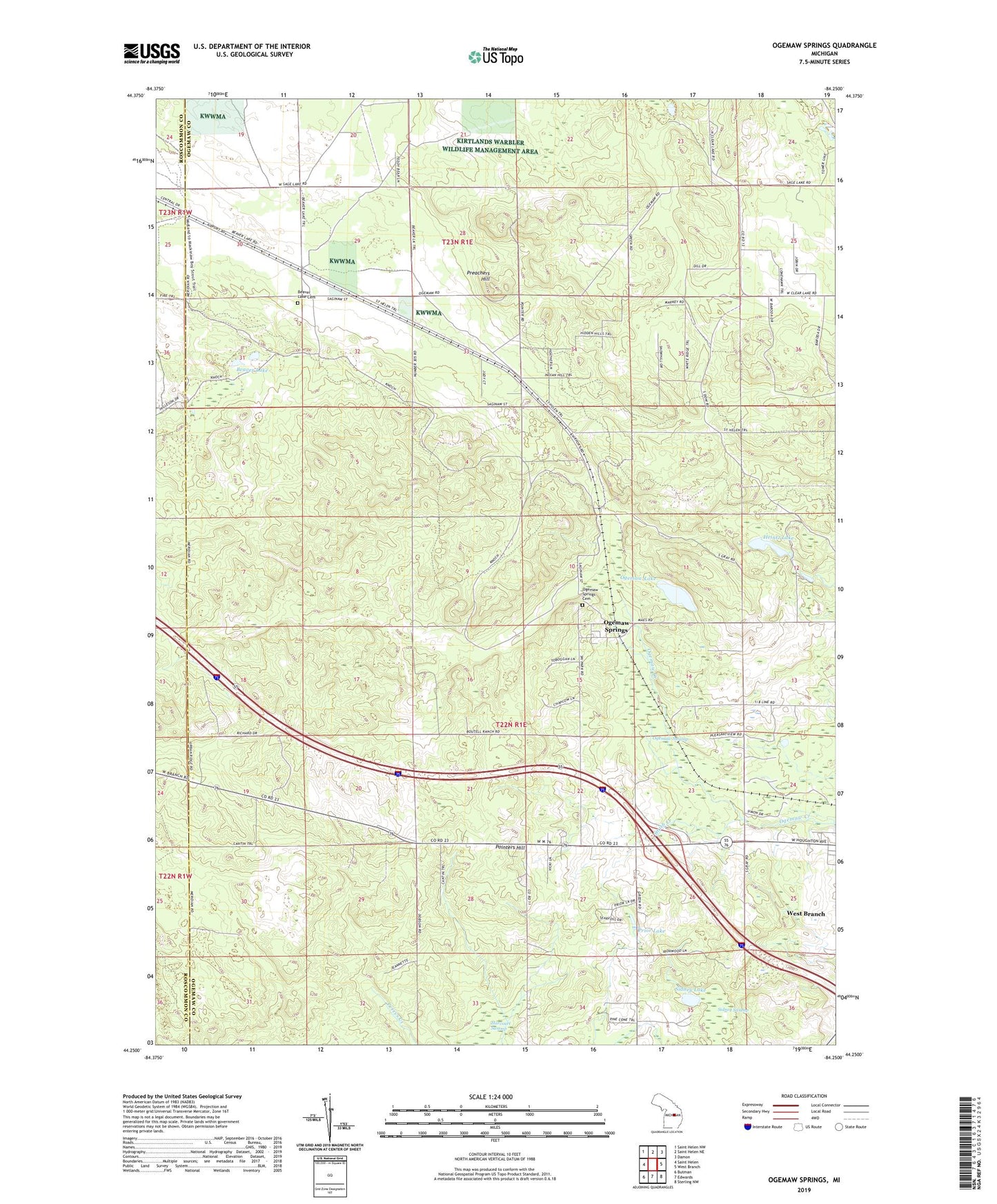
2023 topographic map quadrangle Ogemaw Springs in the state of Michigan. Scale: 1:24000. Based on the newly updated USGS 7.5' US Topo map series, this map is in the following counties: Ogemaw, Roscommon. The map contains contour data, water features, and other items you are used to seeing on USGS maps, but also has updated roads and other features. This is the next generation of topographic maps. Printed on high-quality waterproof paper with UV fade-resistant inks.
Quads adjacent to this one:
West: Saint Helen
Northwest: Saint Helen NW
North: Saint Helen NE
Northeast: Damon
East: West Branch
Southeast: Sterling NW
South: Edwards
Southwest: Butman
This map covers the same area as the classic USGS quad with code o44084c3.
Contains the following named places: Beaver Lake, Beaver Lake Cemetery, Beaver Lake Post Office, Calvary Baptist Church, Free Methodist Church, Harcourt School, Harcourt Swamp, Heintz Lake, Ogemaw Hills Christian School, Ogemaw Lake, Ogemaw Springs, Ogemaw Springs Cemetery, Ogemaw Springs Post Office, Ogemaw Springs Station, Ogemaw Swamp, Ogemaw Township Hall, Pleasant Hill School, Pointers Hill, Preachers Hill, Prior Lake, Sidney Lake, Sidney Swamp, Smith Creek, Township of Ogemaw, WBMB-AM (West Branch), WBMI-FM (West Branch)