MyTopo
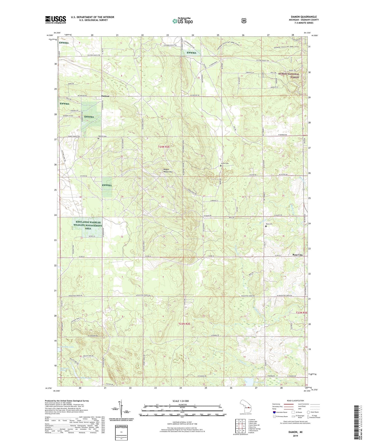
Damon Michigan US Topo Map
Couldn't load pickup availability
Also explore the Damon Forest Service Topo of this same quad for updated USFS data
2023 topographic map quadrangle Damon in the state of Michigan. Scale: 1:24000. Based on the newly updated USGS 7.5' US Topo map series, this map is in the following counties: Ogemaw. The map contains contour data, water features, and other items you are used to seeing on USGS maps, but also has updated roads and other features. This is the next generation of topographic maps. Printed on high-quality waterproof paper with UV fade-resistant inks.
Quads adjacent to this one:
West: Saint Helen NE
Northwest: Luzerne
North: Island Lake
Northeast: Mack Lake
East: Rose City
Southeast: Selkirk
South: West Branch
Southwest: Ogemaw Springs
This map covers the same area as the classic USGS quad with code o44084d2.
Contains the following named places: Barber Creek, Damon, Damon Cemetery, Damon Post Office, Northwoods Baptist Church, Prior Lake, Rose Cemetery, Rose City Lookout Tower, Tamarack Swamp, Townline Lake, Township of Klacking, Tucker Cemetery, Wagon Wheel Hill, Wallin Lake, ZIP Code: 48654