MyTopo
Saint Helen NE Michigan US Topo Map
Couldn't load pickup availability
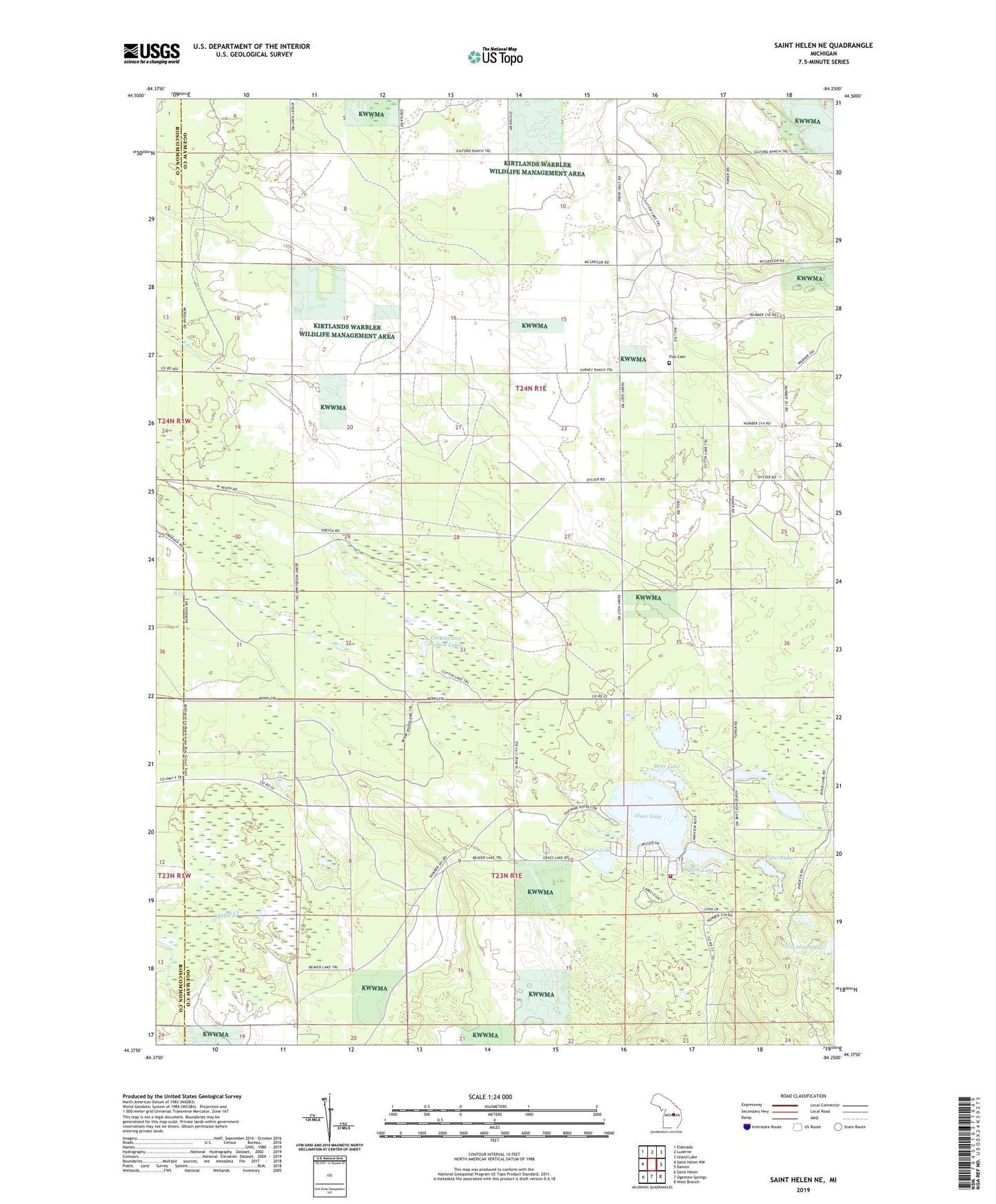
2023 topographic map quadrangle Saint Helen NE in the state of Michigan. Scale: 1:24000. Based on the newly updated USGS 7.5' US Topo map series, this map is in the following counties: Ogemaw, Roscommon. The map contains contour data, water features, and other items you are used to seeing on USGS maps, but also has updated roads and other features. This is the next generation of topographic maps. Printed on high-quality waterproof paper with UV fade-resistant inks.
Quads adjacent to this one:
West: Saint Helen NW
Northwest: Eldorado
North: Luzerne
Northeast: Island Lake
East: Damon
Southeast: West Branch
South: Ogemaw Springs
Southwest: Saint Helen
This map covers the same area as the classic USGS quad with code o44084d3.
Contains the following named places: Ambrose Lake, Ambrose Lake State Forest Campground, Bear Lake, Beaver Trails Campground, Clear Lake, Clear Lake Volunteer Fire Department, Cutting and Damon Lakes, Elni Lake, Fisk Cemetery, Grass Lake, Horseshoe Lake, Piper Lake, Piper Post Office, Rose City Oil Field, Township of Foster