MyTopo
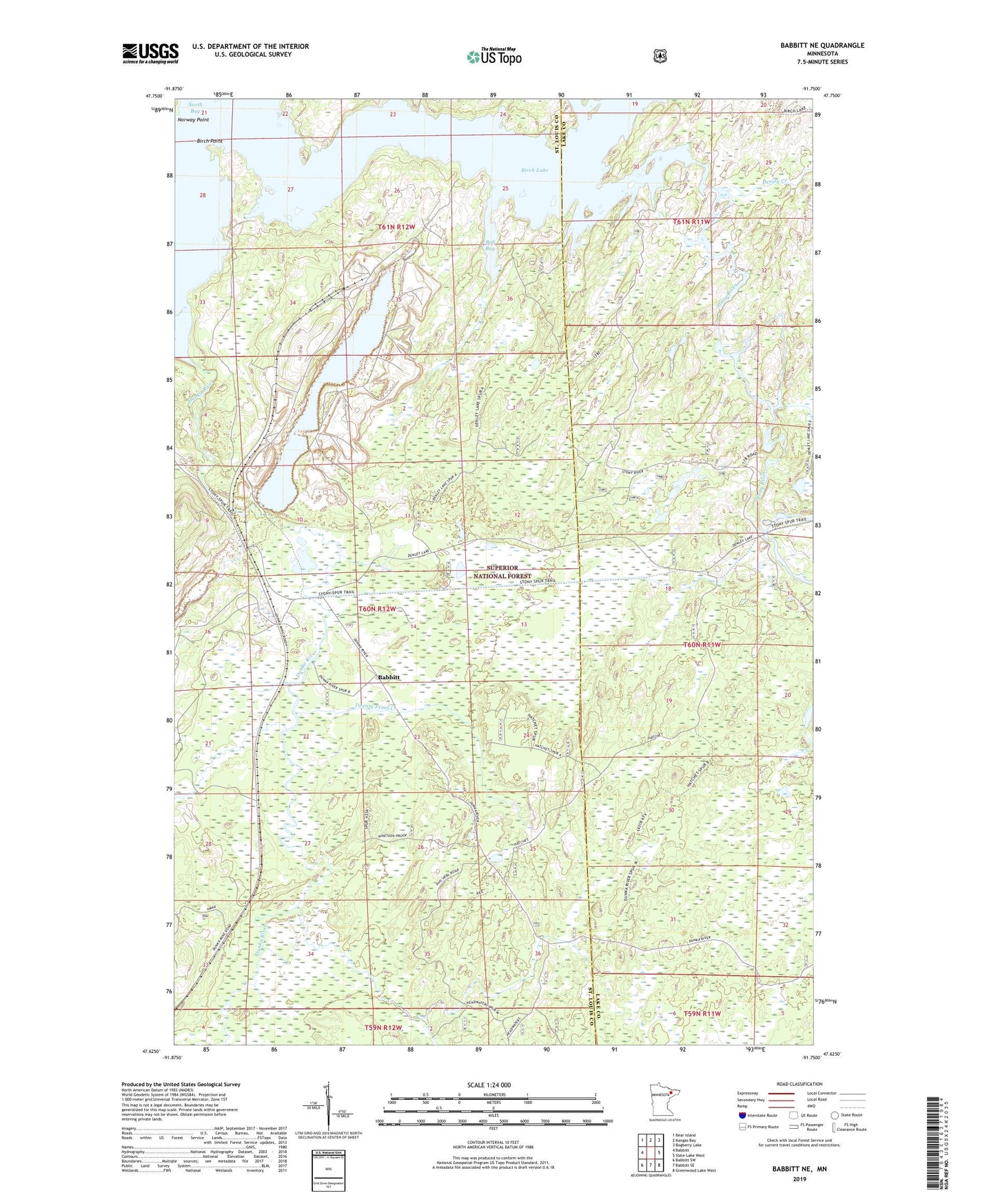
Babbitt NE Minnesota US Topo Map
Couldn't load pickup availability
Also explore the Babbitt NE Forest Service Topo of this same quad for updated USFS data
2022 topographic map quadrangle Babbitt NE in the state of Minnesota. Scale: 1:24000. Based on the newly updated USGS 7.5' US Topo map series, this map is in the following counties: St. Louis, Lake. The map contains contour data, water features, and other items you are used to seeing on USGS maps, but also has updated roads and other features. This is the next generation of topographic maps. Printed on high-quality waterproof paper with UV fade-resistant inks.
Quads adjacent to this one:
West: Babbitt
Northwest: Bear Island
North: Kangas Bay
Northeast: Bogberry Lake
East: Slate Lake West
Southeast: Greenwood Lake West
South: Babbitt SE
Southwest: Babbitt SW
This map covers the same area as the classic USGS quad with code o47091f7.
Contains the following named places: Birch Lake, Birch Point, Bob Bay, Denley Creek, Dunka Bay, Dunka River, Klobuchar Bay, Norway Point, Stony River, Tomahawk Camp, Twenty Proof Creek