MyTopo
Babbitt Minnesota US Topo Map
Couldn't load pickup availability
Also explore the Babbitt Forest Service Topo of this same quad for updated USFS data
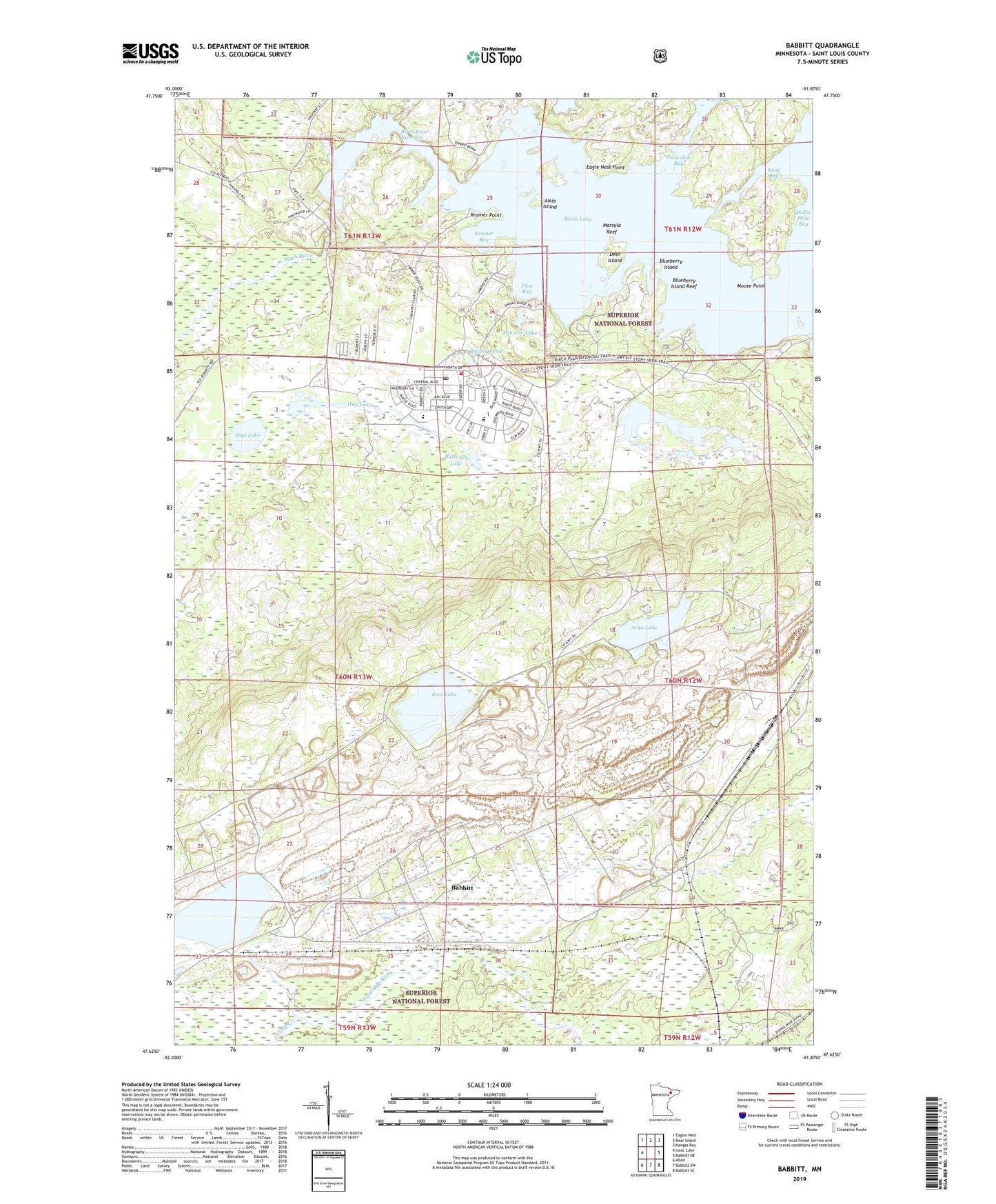
2022 topographic map quadrangle Babbitt in the state of Minnesota. Scale: 1:24000. Based on the newly updated USGS 7.5' US Topo map series, this map is in the following counties: St. Louis. The map contains contour data, water features, and other items you are used to seeing on USGS maps, but also has updated roads and other features. This is the next generation of topographic maps. Printed on high-quality waterproof paper with UV fade-resistant inks.
Quads adjacent to this one:
West: Isaac Lake
Northwest: Eagles Nest
North: Bear Island
Northeast: Kangas Bay
East: Babbitt NE
Southeast: Babbitt SE
South: Babbitt SW
Southwest: Allen
This map covers the same area as the classic USGS quad with code o47091f8.
Contains the following named places: Aikio Island, Argo Lake, Babbitt, Babbitt Ambulance Service, Babbitt Assembly of God Church, Babbitt Baptist Church, Babbitt City Hall, Babbitt High School, Babbitt Police Department, Babbitt Post Office, Babbitt Public Library, Babbitt Volunteer Fire Department, Beaver Pond, Birch Lake and Campgrounds, Birch River, Birch River Narrows, Blueberry Island, Blueberry Island Reef, Butterfly Lake, Camp Rivard, City of Babbitt, Deer Island, Dollar Hide Bay, Duluth Clinic-Babbitt, Eagle Nest Point, Evangelical Lutheran Church, Finn Bay, First Test Pit on the Mesabi Historical Marker, Good Shepherd Lutheran Church, Hay Lake, Iron Lake, Kramer Bay, Kramer Point, Marsyla Reef, Minnow Lake, Moose Point, Mud Lake, Saint Pius Catholic Church, Snowshoe Bay, West Bay, Whisper Lake, Woodland Presbyterian Church, Yelp Creek, ZIP Code: 55706