MyTopo
Baxter Minnesota US Topo Map
Couldn't load pickup availability
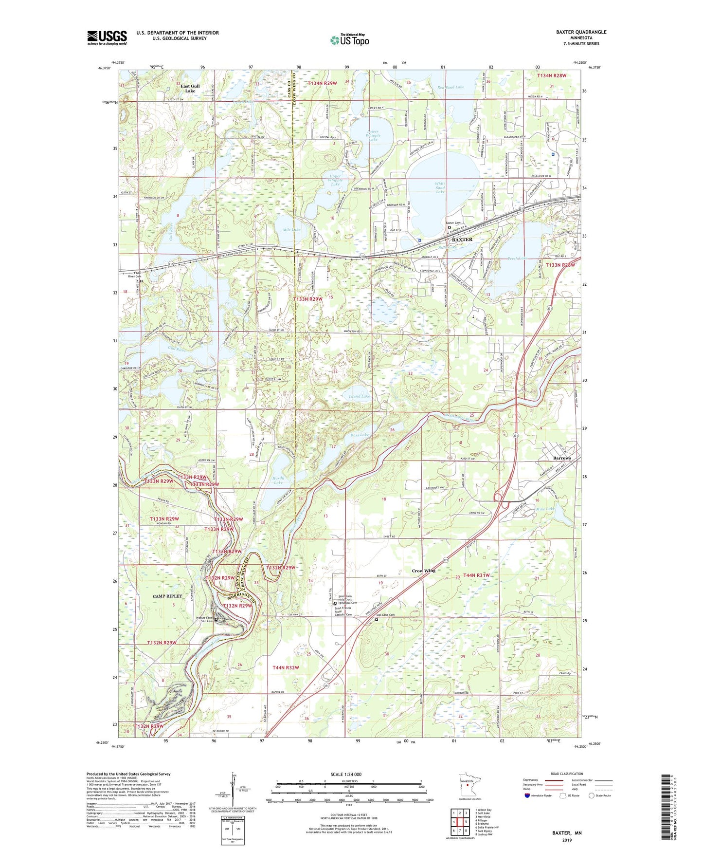
2019 topographic map quadrangle Baxter in the state of Minnesota. Scale: 1:24000. Based on the newly updated USGS 7.5' US Topo map series, this map is in the following counties: Crow Wing, Cass, Morrison. The map contains contour data, water features, and other items you are used to seeing on USGS maps, but also has updated roads and other features. This is the next generation of topographic maps. Printed on high-quality waterproof paper with UV fade-resistant inks.
Quads adjacent to this one:
West: Pillager
Northwest: Wilson Bay
North: Gull Lake
Northeast: Merrifield
East: Brainerd
Southeast: Lastrup NW
South: Fort Ripley
Southwest: Belle Prairie NW
Contains the following named places: Barrows, Barrows Post Office, Bass Lake, Baxter, Baxter Cemetery, Baxter City Hall, Baxter Elementary School, Baxter Police Department, Christ Lutheran Church, City of Baxter, Community Behavioral Health Hospital Baxter, Crow Wing, Crow Wing Post Office, Crow Wing River, Crow Wing School, Crow Wing State Park, Family of Christ Lutheran School, Fort Ripley Historical Marker, Gull River Cemetery, Hardy Lake, Holmes Airfield, Island Lake, Lake Area Christian Church, Lakewood Evangelical Church, Little Pine Resort and Campground, Little Whipple Lake, Lord of Life Lutheran Church, Loren Thompson Park, Lower Whipple Lake, Lynch Lake, Mile Lake, Mine Lake, Oak Land Cemetery, Old Crow Wing Historical Marker, Oscar Kristofferson Park, Perch Lake, Perch Lake Trailer Court, Plumly School, Prosser Farm Site Cemetery, Red Sand Lake, Rush Lake, Saint Francis Assisi Catholic Cemetery, Saint John Holy Cross Episcopal Cemetery, United Pentecostal Church, Upper Whipple Lake, White Sand Lake, WJJY-AM (Baxter), ZIP Code: 56425