MyTopo
Lastrup NW Minnesota US Topo Map
Couldn't load pickup availability
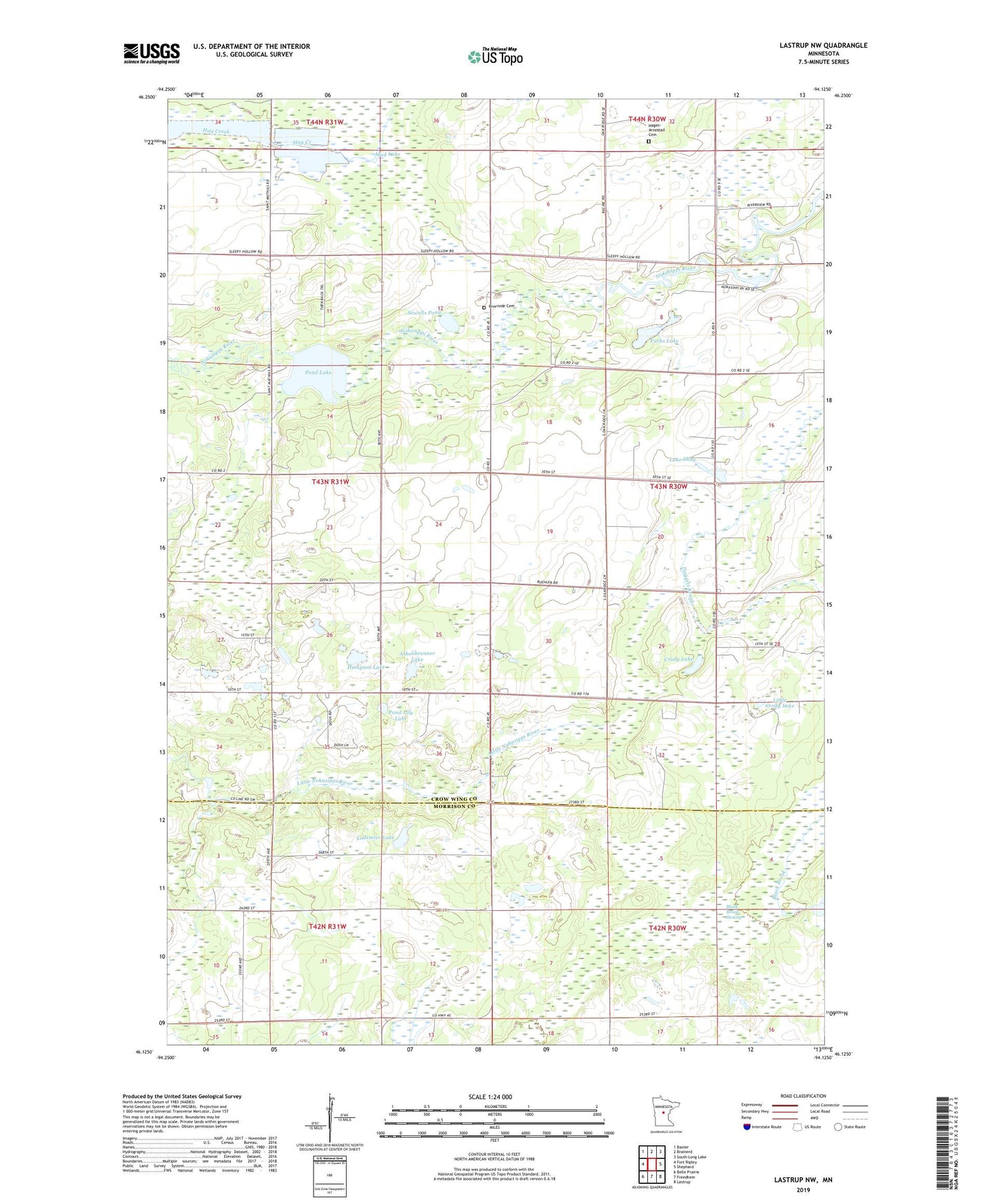
2022 topographic map quadrangle Lastrup NW in the state of Minnesota. Scale: 1:24000. Based on the newly updated USGS 7.5' US Topo map series, this map is in the following counties: Crow Wing, Morrison. The map contains contour data, water features, and other items you are used to seeing on USGS maps, but also has updated roads and other features. This is the next generation of topographic maps. Printed on high-quality waterproof paper with UV fade-resistant inks.
Quads adjacent to this one:
West: Fort Ripley
Northwest: Baxter
North: Brainerd
Northeast: South Long Lake
East: Shephard
Southeast: Lastrup
South: Freedhem
Southwest: Belle Prairie
This map covers the same area as the classic USGS quad with code o46094b2.
Contains the following named places: Ashenbrenner Lake, Black Brook Swamp, Brainerd Lookout Tower, Crody Lake, Crow Wing Church, District Number 112 and 148 School, District Number 19 School, District Number 39 School, District Number 49 School, District Number 84 School, Fuchs Lake, Hagen - Arnestad Cemetery, Hampton Lake, Kohl Landing Strip, Lake Shay, Little Crody Lake, Lodemier Lake, Mud Lake, Pond Lake, Pond Lily Lake, Riverside Cemetery, Round Lake, Round Lake Dam, Sewells Pond, Township of Daggett Brook