MyTopo
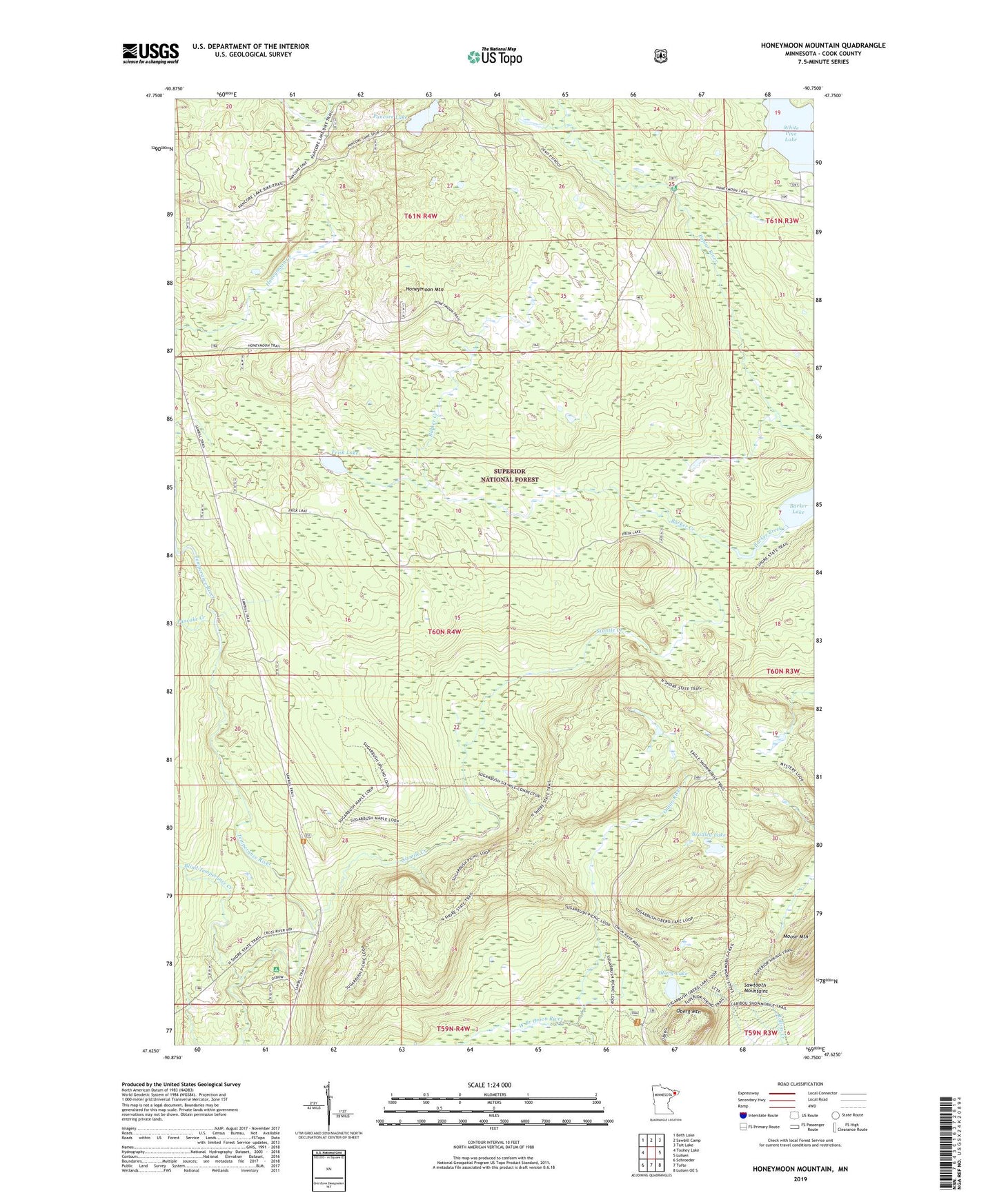
Honeymoon Mountain Minnesota US Topo Map
Couldn't load pickup availability
Also explore the Honeymoon Mountain Forest Service Topo of this same quad for updated USFS data
2022 topographic map quadrangle Honeymoon Mountain in the state of Minnesota. Scale: 1:24000. Based on the newly updated USGS 7.5' US Topo map series, this map is in the following counties: Cook. The map contains contour data, water features, and other items you are used to seeing on USGS maps, but also has updated roads and other features. This is the next generation of topographic maps. Printed on high-quality waterproof paper with UV fade-resistant inks.
Quads adjacent to this one:
West: Toohey Lake
Northwest: Beth Lake
North: Sawbill Camp
Northeast: Tait Lake
East: Lutsen
Southeast: Lutsen OE S
South: Tofte
Southwest: Schroeder
This map covers the same area as the classic USGS quad with code o47090f7.
Contains the following named places: Blind Temperance Creek, Bradley Lake, Frisk Lake, Honeymoon Lookout Tower, Honeymoon Mountain, Honeymoon Trail, Oberg Lake, Oberg Mountain, Pancake Creek, Pancore Lake, Poplar River Campground, Sixmile Creek, West Branch Onion River, White Pine Lake, ZIP Code: 55615