MyTopo
Orwell Lake Minnesota US Topo Map
Couldn't load pickup availability
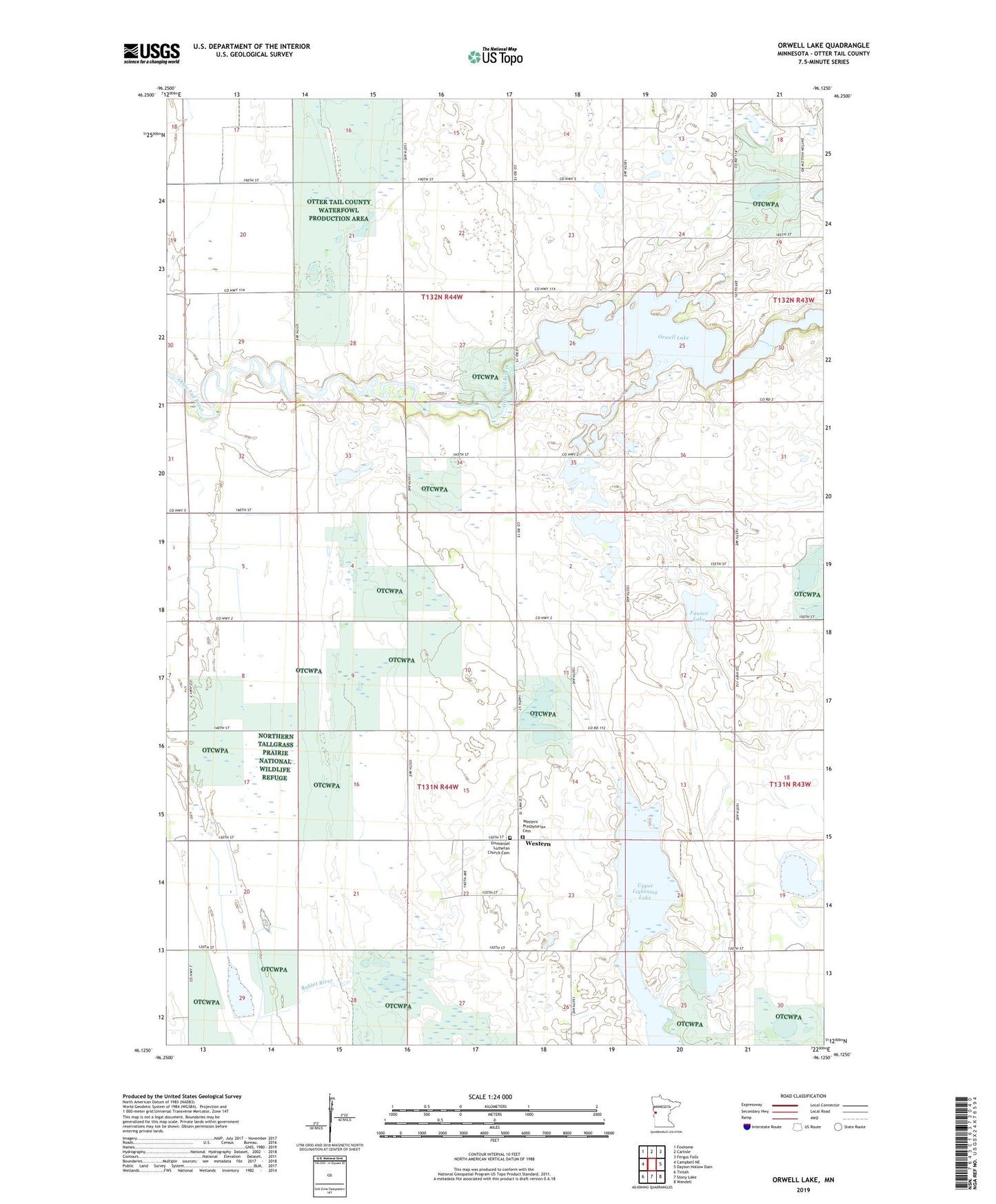
2022 topographic map quadrangle Orwell Lake in the state of Minnesota. Scale: 1:24000. Based on the newly updated USGS 7.5' US Topo map series, this map is in the following counties: Otter Tail. The map contains contour data, water features, and other items you are used to seeing on USGS maps, but also has updated roads and other features. This is the next generation of topographic maps. Printed on high-quality waterproof paper with UV fade-resistant inks.
Quads adjacent to this one:
West: Campbell NE
Northwest: Foxhome
North: Carlisle
Northeast: Fergus Falls
East: Dayton Hollow Dam
Southeast: Wendell
South: Stony Lake
Southwest: Tintah
This map covers the same area as the classic USGS quad with code o46096b2.
Contains the following named places: Doran State Wildlife Management Area, Emmanuel Lutheran Church Cemetery, Faunce Lake, Orwell Dam, Orwell Lake, Orwell Reservoir and Dam, Orwell State Wildlife Management Area, Roberts, Roberts Post Office, School Number 197, School Number 243, School Number 252, School Number 261, School Number 264, School Number 49, School Number 56, Township of Orwell, Township of Western, Western, Western Post Office, Western Presbyterian Cemetery, Western Presbyterian Church