MyTopo
Stony Lake Minnesota US Topo Map
Couldn't load pickup availability
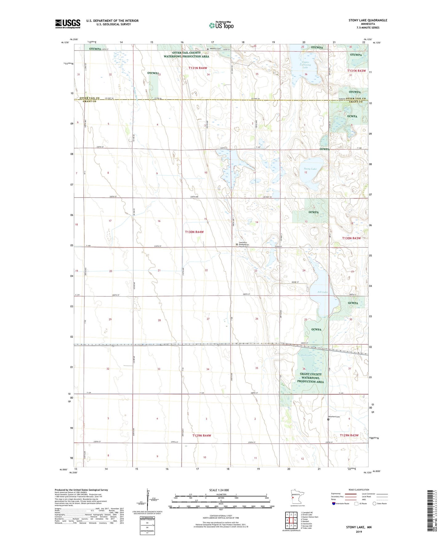
2022 topographic map quadrangle Stony Lake in the state of Minnesota. Scale: 1:24000. Based on the newly updated USGS 7.5' US Topo map series, this map is in the following counties: Grant, Otter Tail. The map contains contour data, water features, and other items you are used to seeing on USGS maps, but also has updated roads and other features. This is the next generation of topographic maps. Printed on high-quality waterproof paper with UV fade-resistant inks.
Quads adjacent to this one:
West: Tintah
Northwest: Campbell NE
North: Orwell Lake
Northeast: Dayton Hollow Dam
East: Wendell
Southeast: Trisko Lake
South: Herman NW
Southwest: Charlesville
This map covers the same area as the classic USGS quad with code o46096a2.
Contains the following named places: Ash Lake, Copeland State Wildlife Management Area, Hereford, Hereford Cemetery, Kube-swift State Wildlife Management Areas, Lawrence Church, Lawrence Presbyterian Church Cemetery, Marple State Wildlife Management Area, Mud Lake, School Number 24, School Number 28, School Number 36, School Number 45, School Number 61, Shuck State Wildlife Management Area, Stony Lake, Township of Lawrence, Upper Lightning Lake, Western Cemetery, ZIP Code: 56590