MyTopo
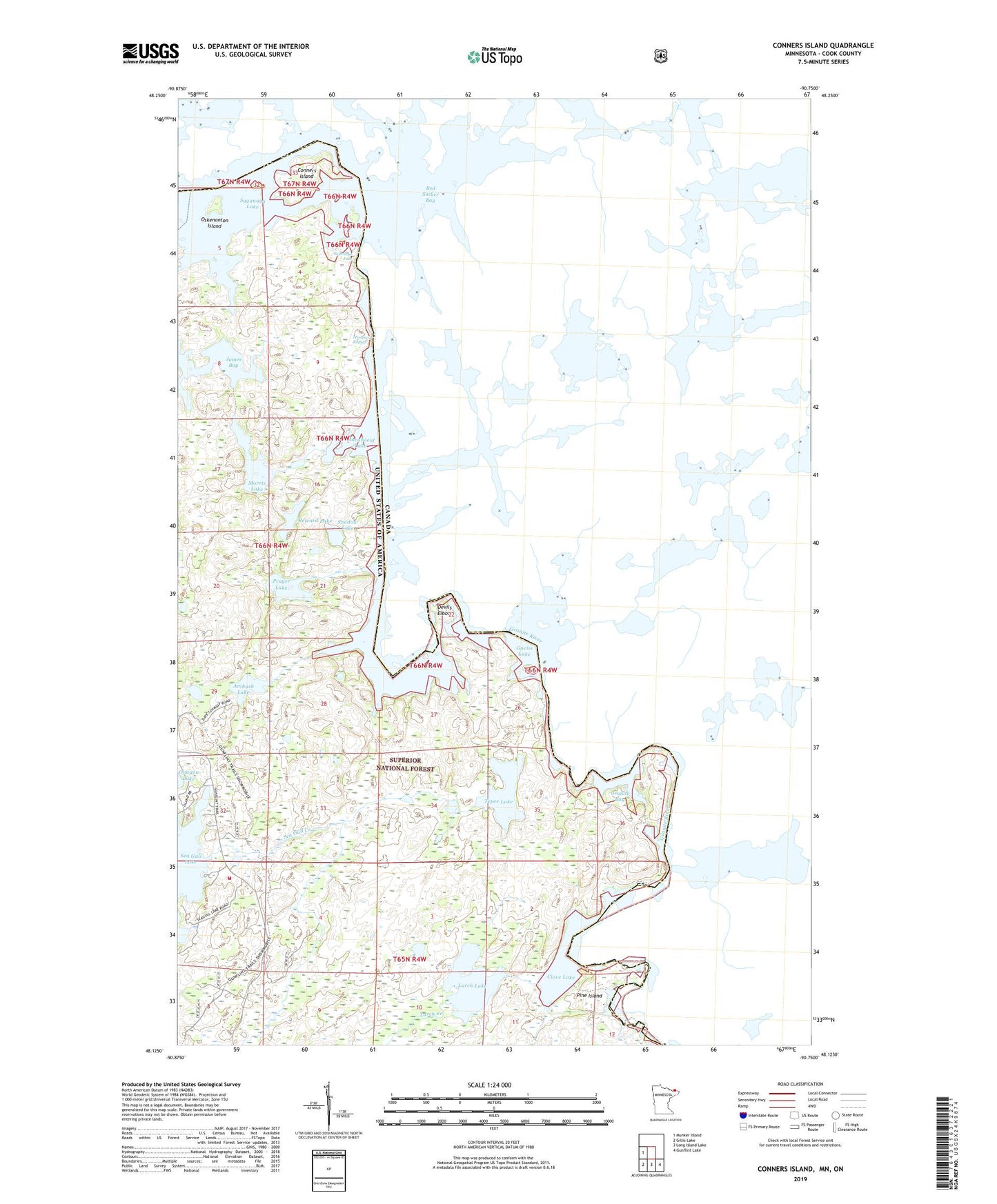
Conners Island Minnesota US Topo Map
Couldn't load pickup availability
Also explore the Conners Island Forest Service Topo of this same quad for updated USFS data
2022 topographic map quadrangle Conners Island in the state of Minnesota. Scale: 1:24000. Based on the newly updated USGS 7.5' US Topo map series, this map is in the following counties: Cook. The map contains contour data, water features, and other items you are used to seeing on USGS maps, but also has updated roads and other features. This is the next generation of topographic maps. Printed on high-quality waterproof paper with UV fade-resistant inks.
Quads adjacent to this one:
West: Munker Island
Southeast: Gunflint Lake
South: Long Island Lake
Southwest: Gillis Lake
This map covers the same area as the classic USGS quad with code o48090b7.
Contains the following named places: Ambush Lake, Blackenburg Landing, Clove Lake, Conners Island, Devils Elbow, Gneiss Lake, Gneiss Lake Portage, Gneiss Trail, Granite Bay, Granite River, Granite River Portage, Gunflint Trail Volunteer Fire Department Station 3, Horsetail Rapids, James Bay, Larch Creek, Larch Lake, Maraboeuf Lake, Maraboeuf Lake Portage, Morris Lake, Oskenonton Island, Pine Island, Pine Portage, Pine River, Prayer Lake, Red Sucker Bay, Reward Lake, Saganaga Falls, Sea Gull Creek, Shadow Lake, Tepee Lake