MyTopo
Wendell Minnesota US Topo Map
Couldn't load pickup availability
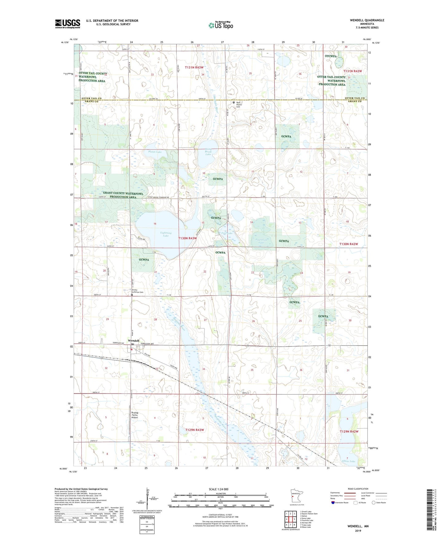
2022 topographic map quadrangle Wendell in the state of Minnesota. Scale: 1:24000. Based on the newly updated USGS 7.5' US Topo map series, this map is in the following counties: Grant, Otter Tail. The map contains contour data, water features, and other items you are used to seeing on USGS maps, but also has updated roads and other features. This is the next generation of topographic maps. Printed on high-quality waterproof paper with UV fade-resistant inks.
Quads adjacent to this one:
West: Stony Lake
Northwest: Orwell Lake
North: Dayton Hollow Dam
Northeast: Dalton
East: Fourmile Lake
Southeast: Elbow Lake
South: Trisko Lake
Southwest: Herman NW
This map covers the same area as the classic USGS quad with code o46096a1.
Contains the following named places: Aastad Post Office, Bergerud State Wildlife Management Area, Brutlag Farms Airport, City of Wendell, Elbow Lake, Engralson Lake, Foss Lake, Grant County Waterfowl Production Area, Lightning Lake, Mustinka State Wildlife Management Area, Pletan Lake, Rock Prairie Cemetery, Rock Prairie Lutheran Church, School Number 12, School Number 29 East, School Number 29 West, School Number 30, School Number 54, Stony Brook Lake, Swift Airport, Township of Stony Brook, Trinity Lutheran Cemetery, Trinity Lutheran Church, Wendell, Wendell Fire Department, Wendell Post Office