MyTopo
Dayton Hollow Dam Minnesota US Topo Map
Couldn't load pickup availability
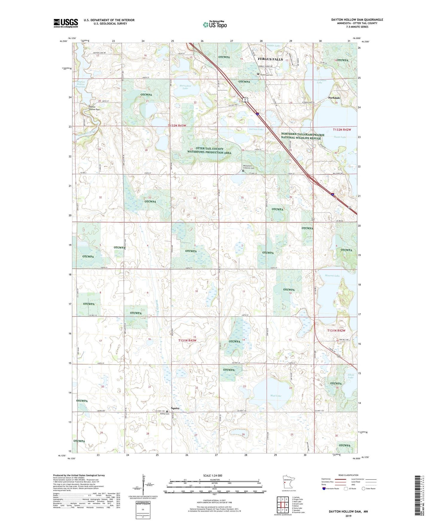
2022 topographic map quadrangle Dayton Hollow Dam in the state of Minnesota. Scale: 1:24000. Based on the newly updated USGS 7.5' US Topo map series, this map is in the following counties: Otter Tail. The map contains contour data, water features, and other items you are used to seeing on USGS maps, but also has updated roads and other features. This is the next generation of topographic maps. Printed on high-quality waterproof paper with UV fade-resistant inks.
Quads adjacent to this one:
West: Orwell Lake
Northwest: Carlisle
North: Fergus Falls
Northeast: Wall Lake
East: Dalton
Southeast: Fourmile Lake
South: Wendell
Southwest: Stony Lake
This map covers the same area as the classic USGS quad with code o46096b1.
Contains the following named places: Aastad Cemetery, Aastad Church, Aastad State Wildlife Management Area, Alkali Lake, Bethlehem Lutheran Cemetery, Chautauqua Lake, Country Manor Mobile Home Park, Dayton Hollow Dam, Dayton Hollow Reservoir, Hi-view State Wildlife Management Area, Horseshoe Lake, Iverson Lake, Knollwood Cemetery, Lake Iverson East Bound Rest Area, Mineral Lake, Mud Lake, Parkdale, Pebble Lake Golf Course, Pebble Lake Park, School Number 118, School Number 119, School Number 157, School Number 30, School Number 31, School Number 46, School Number 64, Squier, Squier Post Office, Swan Lake, The Land of Ten Thousand Lakes Historical Marker, Township of Aastad, Township of Buse, United States Fish and Wildlife Service Fergus Falls Wetland Management District, Valdine State Wildlife Management Area