MyTopo
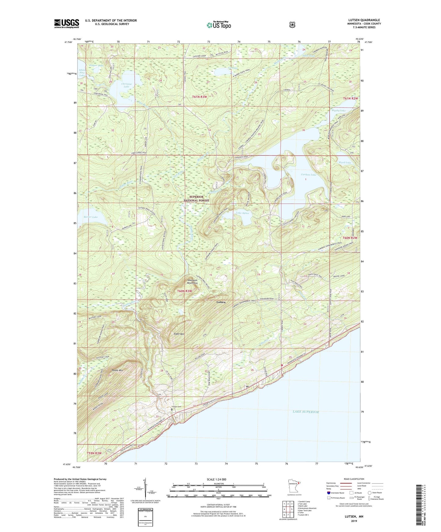
Lutsen Minnesota US Topo Map
Couldn't load pickup availability
Also explore the Lutsen Forest Service Topo of this same quad for updated USFS data
2022 topographic map quadrangle Lutsen in the state of Minnesota. Scale: 1:24000. Based on the newly updated USGS 7.5' US Topo map series, this map is in the following counties: Cook. The map contains contour data, water features, and other items you are used to seeing on USGS maps, but also has updated roads and other features. This is the next generation of topographic maps. Printed on high-quality waterproof paper with UV fade-resistant inks.
Quads adjacent to this one:
West: Honeymoon Mountain
Northwest: Sawbill Camp
North: Tait Lake
Northeast: Mark Lake
East: Deer Yard Lake
South: Lutsen OE S
Southwest: Tofte
This map covers the same area as the classic USGS quad with code o47090f6.
Contains the following named places: Alfred Creek, Barker Creek, Barker Lake, Bigsby Lake, Caribou Creek, Caribou Lake, Christine Lake, Eagle Mountain, Halls Pond, Jonvick Creek, Lake Agnes, Lutsen, Lutsen Cemetery, Lutsen Census Designated Place, Lutsen Lutheran Church, Lutsen Mobile Home Park, Lutsen Post Office, Lutsen Ski Area, Lutsen Township Volunteer Fire Department, Mistletoe Creek, Moose Mountain, Murmur Creek, Pengar Lake, Poplar River, Superior National Course, Tait River, Vat Lake, Ward Lake