MyTopo
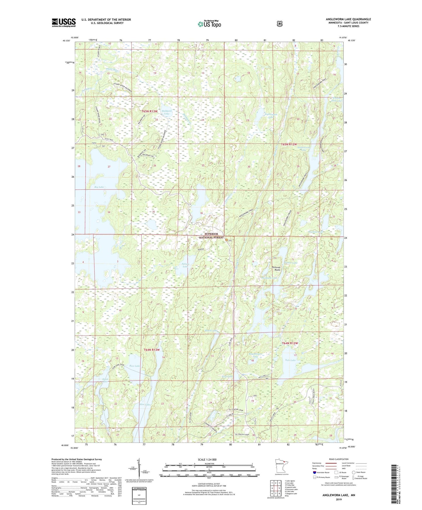
Angleworm Lake Minnesota US Topo Map
Couldn't load pickup availability
Also explore the Angleworm Lake Forest Service Topo of this same quad for updated USFS data
2022 topographic map quadrangle Angleworm Lake in the state of Minnesota. Scale: 1:24000. Based on the newly updated USGS 7.5' US Topo map series, this map is in the following counties: St. Louis. The map contains contour data, water features, and other items you are used to seeing on USGS maps, but also has updated roads and other features. This is the next generation of topographic maps. Printed on high-quality waterproof paper with UV fade-resistant inks.
Quads adjacent to this one:
West: Lapond Lake
Northwest: Lake Agnes
North: Iron Lake
Northeast: Friday Bay
East: Fourtown Lake
Southeast: Ely
South: Shagawa Lake
Southwest: Crab Lake
This map covers the same area as the classic USGS quad with code o48091a8.
Contains the following named places: Agassa Lake, Angleworm Lake, Angleworm Lookout Tower, Baldpate Creek, Baldpate Lake, Big Lake, Chorus Lake, Ed Shave Lake, First Lake, Hardtack Lake, Hook Lake, Hopkins Lake, Hunch Lake, Keneu Lake, Little Bass Lake, Nels Lake, Nightingale Lake, North Hegman Lake, Pictured Rocks, Regenbogen Lake, Rice Lake, Second Creek, Slim Lake, South Hegman Lake, Stuart Portage, Swamp Creek, Tee Lake, Trease Lake, Unorganized Territory of Slim Lake