MyTopo
Judson Minnesota US Topo Map
Couldn't load pickup availability
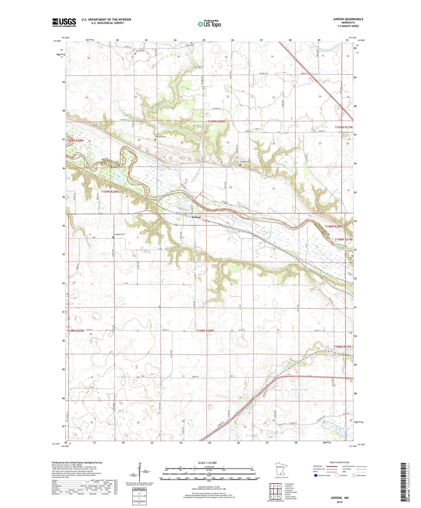
2022 topographic map quadrangle Judson in the state of Minnesota. Scale: 1:24000. Based on the newly updated USGS 7.5' US Topo map series, this map is in the following counties: Blue Earth, Nicollet. The map contains contour data, water features, and other items you are used to seeing on USGS maps, but also has updated roads and other features. This is the next generation of topographic maps. Printed on high-quality waterproof paper with UV fade-resistant inks.
Quads adjacent to this one:
West: Cambria
Northwest: Courtland
North: Nicollet
Northeast: North Star
East: Mankato West
Southeast: Good Thunder
South: Lake Crystal
Southwest: Perth
This map covers the same area as the classic USGS quad with code o44094b2.
Contains the following named places: Hebron Cemetery, Horseshoe Lake, Jerusalem Cemetery, Judson, Judson Post Office, KXLP-FM (New Ulm), McGibneys Lake, Mennenga Lake, Michels Farm Airport, Rush Lake, Swan Lake Outlet, Township of Judson, Township of Nicollet, Trinity Cemetery, Welsh Heritage Farms, Williams Cemetery, Zion Cemetery, ZIP Code: 56055