MyTopo
Lake Crystal Minnesota US Topo Map
Couldn't load pickup availability
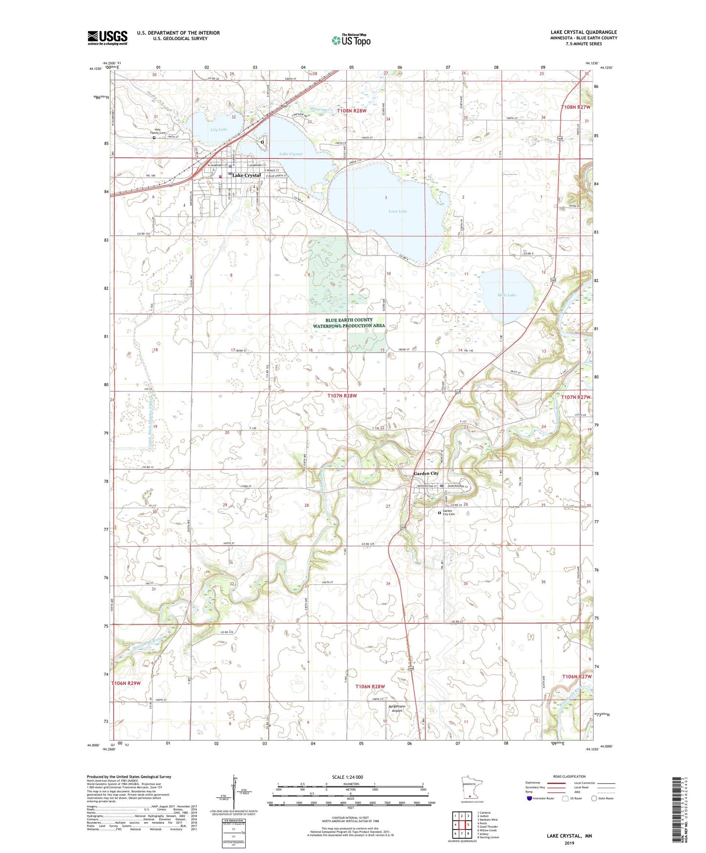
2022 topographic map quadrangle Lake Crystal in the state of Minnesota. Scale: 1:24000. Based on the newly updated USGS 7.5' US Topo map series, this map is in the following counties: Blue Earth. The map contains contour data, water features, and other items you are used to seeing on USGS maps, but also has updated roads and other features. This is the next generation of topographic maps. Printed on high-quality waterproof paper with UV fade-resistant inks.
Quads adjacent to this one:
West: Perth
Northwest: Cambria
North: Judson
Northeast: Mankato West
East: Good Thunder
Southeast: Sterling Center
South: Amboy
Southwest: Willow Creek
This map covers the same area as the classic USGS quad with code o44094a2.
Contains the following named places: Bergemann Airport, City of Lake Crystal, County Ditch Number Fiftysix, County Ditch Number Seventyeight, County Ditch Number Twentyseven, First Baptist Church, First Presbyterian Church, First United Methodist Church, Garden City, Garden City Cemetery, Garden City Census Designated Place, Garden City Christian Church, Garden City Post Office, Holy Family Catholic Church, Holy Family Cemetery, Lake Crystal, Lake Crystal Area Ambulance, Lake Crystal Cemetery, Lake Crystal City Hall, Lake Crystal Elementary School, Lake Crystal Family Medicine Center, Lake Crystal Fire Department, Lake Crystal Health Care Center, Lake Crystal Memorial High School, Lake Crystal Police Department, Lake Crystal Post Office, Lake Crystal Public Library, Lake Crystal Wellcome Memorial School, Lily Lake, Loon Lake, Mills Lake, Parkview Medical Clinic, Rambush Estates II, Robinson Park, Shady Oaks Campground, Township of Garden City, Trinity Lutheran Church, Watonwan River, Wells Creek, Zion Lutheran Church, ZIP Code: 56034