MyTopo
Lake Agnes Minnesota US Topo Map
Couldn't load pickup availability
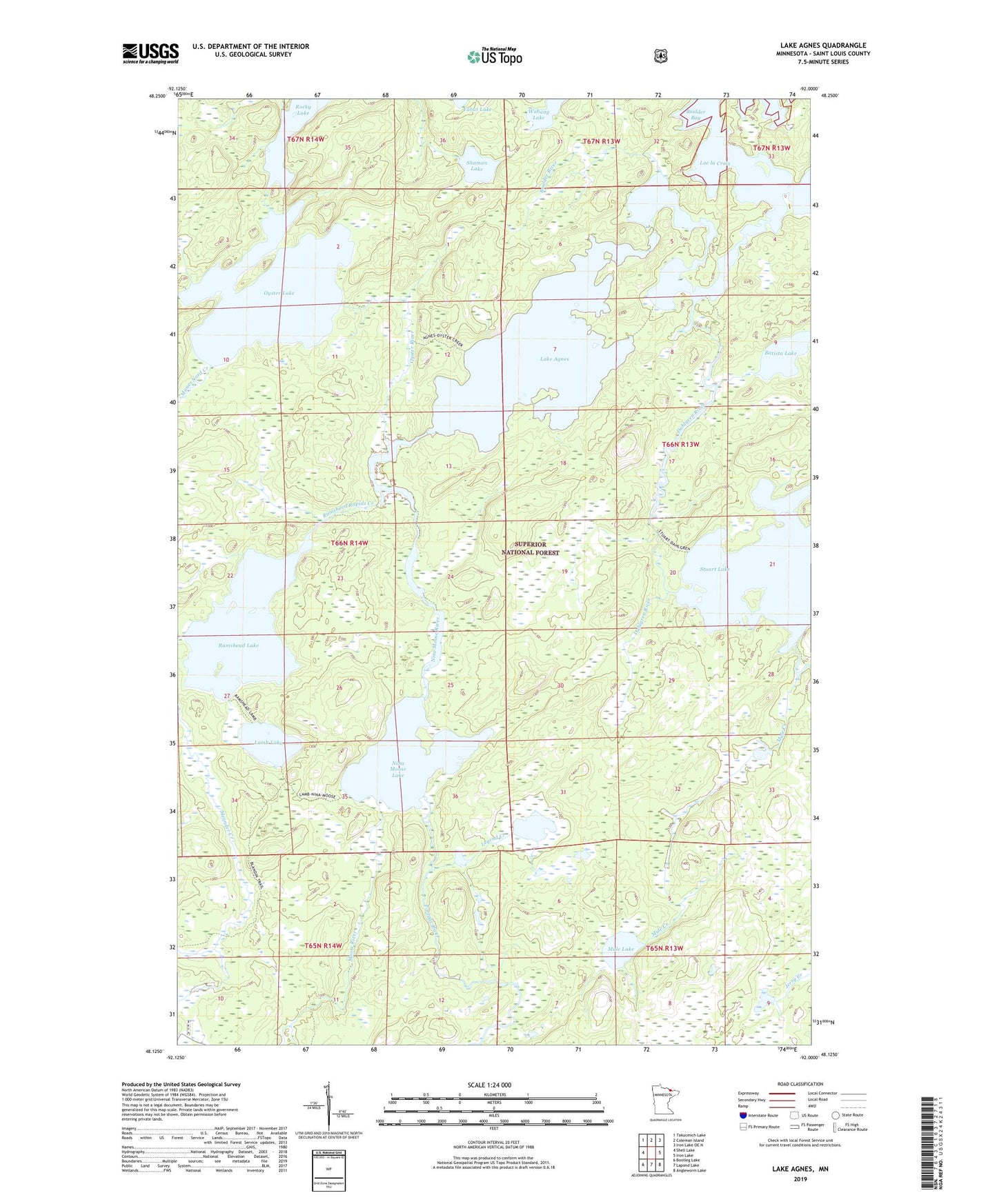
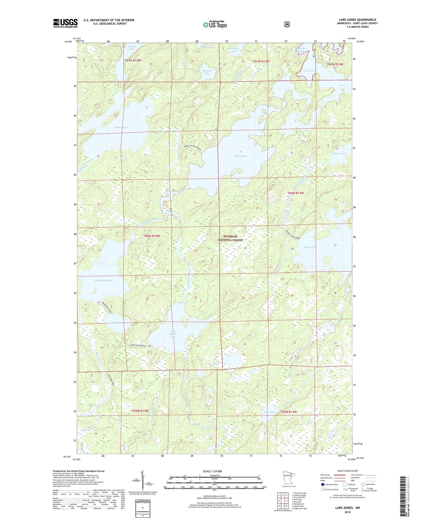
2019 topographic map quadrangle Lake Agnes in the state of Minnesota. Scale: 1:24000. Based on the newly updated USGS 7.5' US Topo map series, this map is in the following counties: St. Louis. The map contains contour data, water features, and other items you are used to seeing on USGS maps, but also has updated roads and other features. This is the next generation of topographic maps. Printed on high-quality waterproof paper with UV fade-resistant inks.
Quads adjacent to this one:
West: Shell Lake
Northwest: Takucmich Lake
North: Coleman Island
Northeast: Iron Lake OE N
East: Iron Lake
Southeast: Angleworm Lake
South: Lapond Lake
Southwest: Bootleg Lake
Contains the following named places: Batista Lake, Boulder Bay, Boulder River, Dahlgren River, Johns Creek, Lake Agnes, Lamb Lake, Legend Creek, Legend Lake, Manes Nord Creek, Moose River, Mule Creek, Mule Lake, Nina Moose Lake, Nina Moose River, Oyster Lake, Oyster River, Portage River, Ramshead Lake, Ramshead Rapids Creek, Rocky Lake, Shaman Lake, Stuart Lake, Stuart River, Tiger Bay