MyTopo
Lapond Lake Minnesota US Topo Map
Couldn't load pickup availability
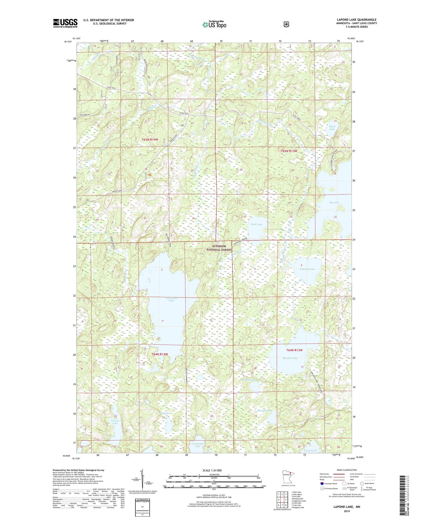
2019 topographic map quadrangle Lapond Lake in the state of Minnesota. Scale: 1:24000. Based on the newly updated USGS 7.5' US Topo map series, this map is in the following counties: St. Louis. The map contains contour data, water features, and other items you are used to seeing on USGS maps, but also has updated roads and other features. This is the next generation of topographic maps. Printed on high-quality waterproof paper with UV fade-resistant inks.
Quads adjacent to this one:
West: Bootleg Lake
Northwest: Shell Lake
North: Lake Agnes
Northeast: Iron Lake
East: Angleworm Lake
Southeast: Shagawa Lake
South: Crab Lake
Southwest: Chad Lake
Contains the following named places: Big Moose Lake, Big Rice Lake, Bill Creek, Blizzard Lake, Duck Creek, Duck Lake, Lapond Lake, Medley Lake, Moose River Portage, Neewin Lake, Third Lake, Tubfull Creek, Wail Lake