MyTopo
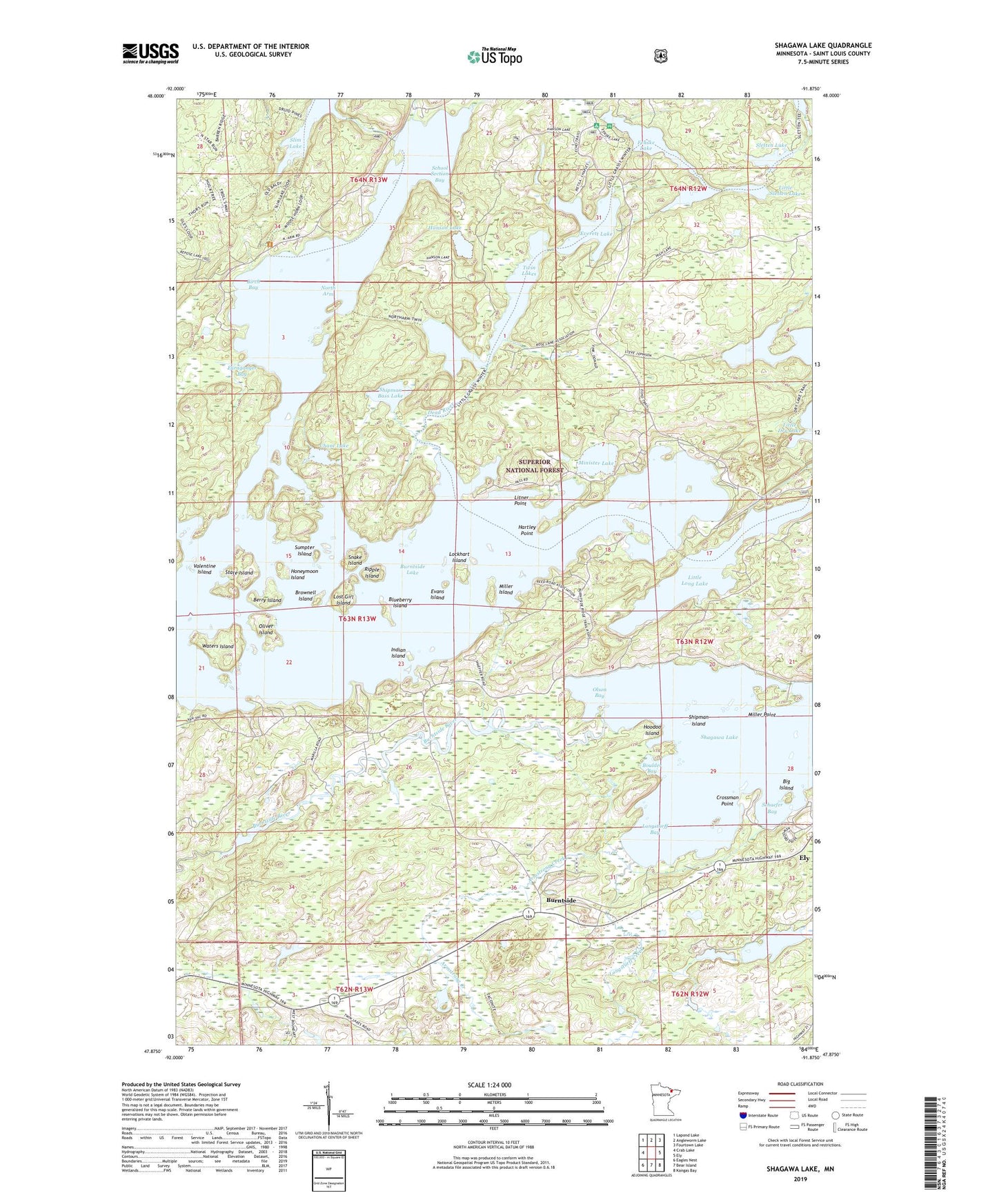
Shagawa Lake Minnesota US Topo Map
Couldn't load pickup availability
Also explore the Shagawa Lake Forest Service Topo of this same quad for updated USFS data
2022 topographic map quadrangle Shagawa Lake in the state of Minnesota. Scale: 1:24000. Based on the newly updated USGS 7.5' US Topo map series, this map is in the following counties: St. Louis. The map contains contour data, water features, and other items you are used to seeing on USGS maps, but also has updated roads and other features. This is the next generation of topographic maps. Printed on high-quality waterproof paper with UV fade-resistant inks.
Quads adjacent to this one:
West: Crab Lake
Northwest: Lapond Lake
North: Angleworm Lake
Northeast: Fourtown Lake
East: Ely
Southeast: Kangas Bay
South: Bear Island
Southwest: Eagles Nest
This map covers the same area as the classic USGS quad with code o47091h8.
Contains the following named places: Armstrong Creek, Berry Island, Big Island, Birch Bay, Blueberry Island, Boulder Bay, Brownell Island, Burntside, Burntside Lake, Burntside Post Office, Burntside River, Burntside Station, Chant Lake, Crossman Point, Dead River, Evans Island, Everett Lake, Fenske Lake, Fenske Lake Campground, Furaganger Bay, Hanson Lake, Hartley Point, High Lake, Honeymoon Island, Hoodoo Island, Indian Island, Litner Point, Little Dry Lake, Little Long Lake, Little Sletten Lake, Lockhart Island, Longstorff Bay, Longstorff Creek, Lost Girl Island, Miller Island, Miller Point, Minister Lake, North Arm, Okorb Island, Oliver Island, Olson Bay, Pioneer Clarification Basin, Pioneer Clarification Dike, Pioneer Tailings Basin, Pioneer Tailings Dike, Ripple Island, Schaefer Bay, School Section Bay, Semer Park, Shagawa Lake, Shagawa Lake Seaplane Base, Shipman Bass Lake, Shipman Island, Sletten Lake, Snake Island, State Island, Sumpter Island, Township of Morse, Twin Lakes, Valentine Island, Waters Island