MyTopo
Lastrup Minnesota US Topo Map
Couldn't load pickup availability
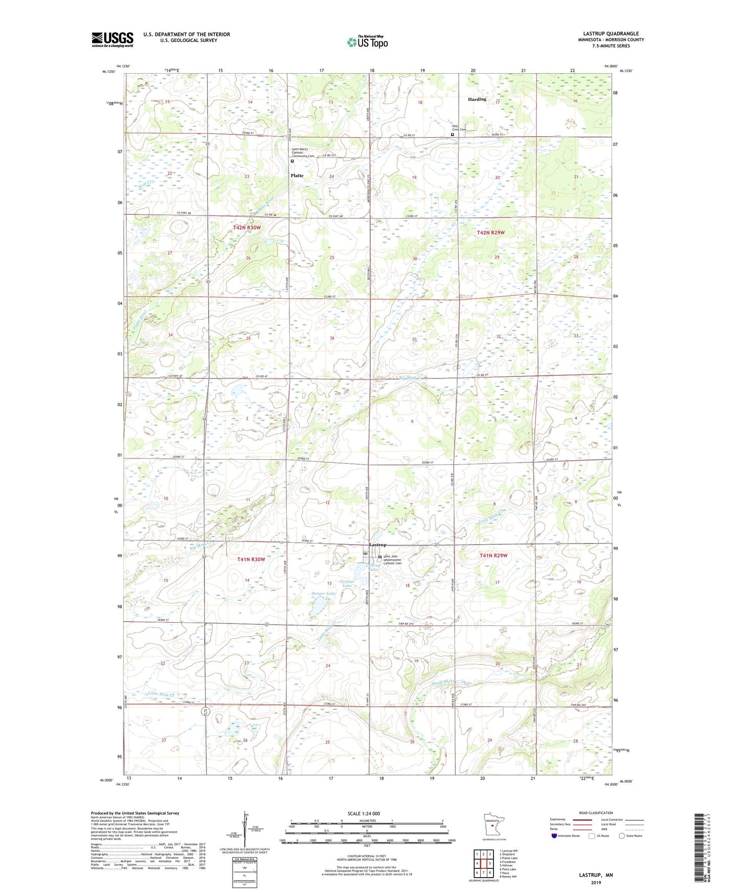
2022 topographic map quadrangle Lastrup in the state of Minnesota. Scale: 1:24000. Based on the newly updated USGS 7.5' US Topo map series, this map is in the following counties: Morrison. The map contains contour data, water features, and other items you are used to seeing on USGS maps, but also has updated roads and other features. This is the next generation of topographic maps. Printed on high-quality waterproof paper with UV fade-resistant inks.
Quads adjacent to this one:
West: Freedhem
Northwest: Lastrup NW
North: Shephard
Northeast: Platte Lake
East: Hillman
Southeast: Ramey NW
South: Pierz
Southwest: Pierz Lake
This map covers the same area as the classic USGS quad with code o46094a1.
Contains the following named places: Buh Town Hall, City of Harding, City of Lastrup, Denger Lake, District Number 123 School, District Number 134 School, District Number 36 School, District Number 55 School, District Number 71 School, District Number 87 School, District Number 90 School, Free Polish National Church, Granite Town Hall, Harding, Harding Post Office, Holy Cross Cemetery, Holy Cross Church, Lastrup, Lastrup Lake, Lastrup Post Office, Ortman Lake, Platte, Platte Post Office, Saint John Nepomucene Catholic Cemetery, Saint Mary's Catholic Community Cemetery, Wolf Creek, ZIP Code: 56364