MyTopo
Laura Lake Minnesota US Topo Map
Couldn't load pickup availability
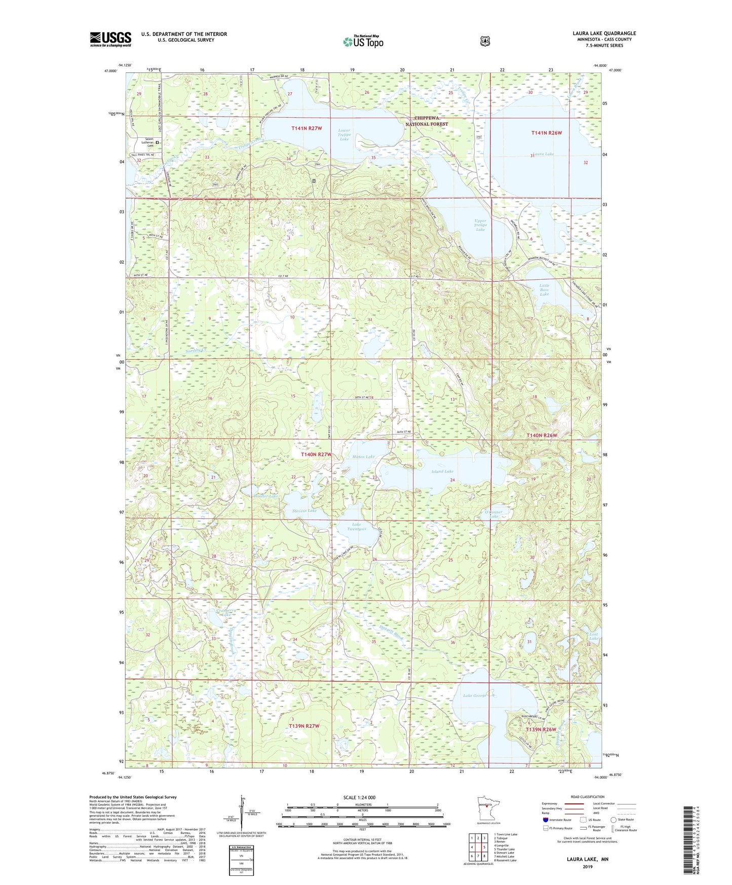
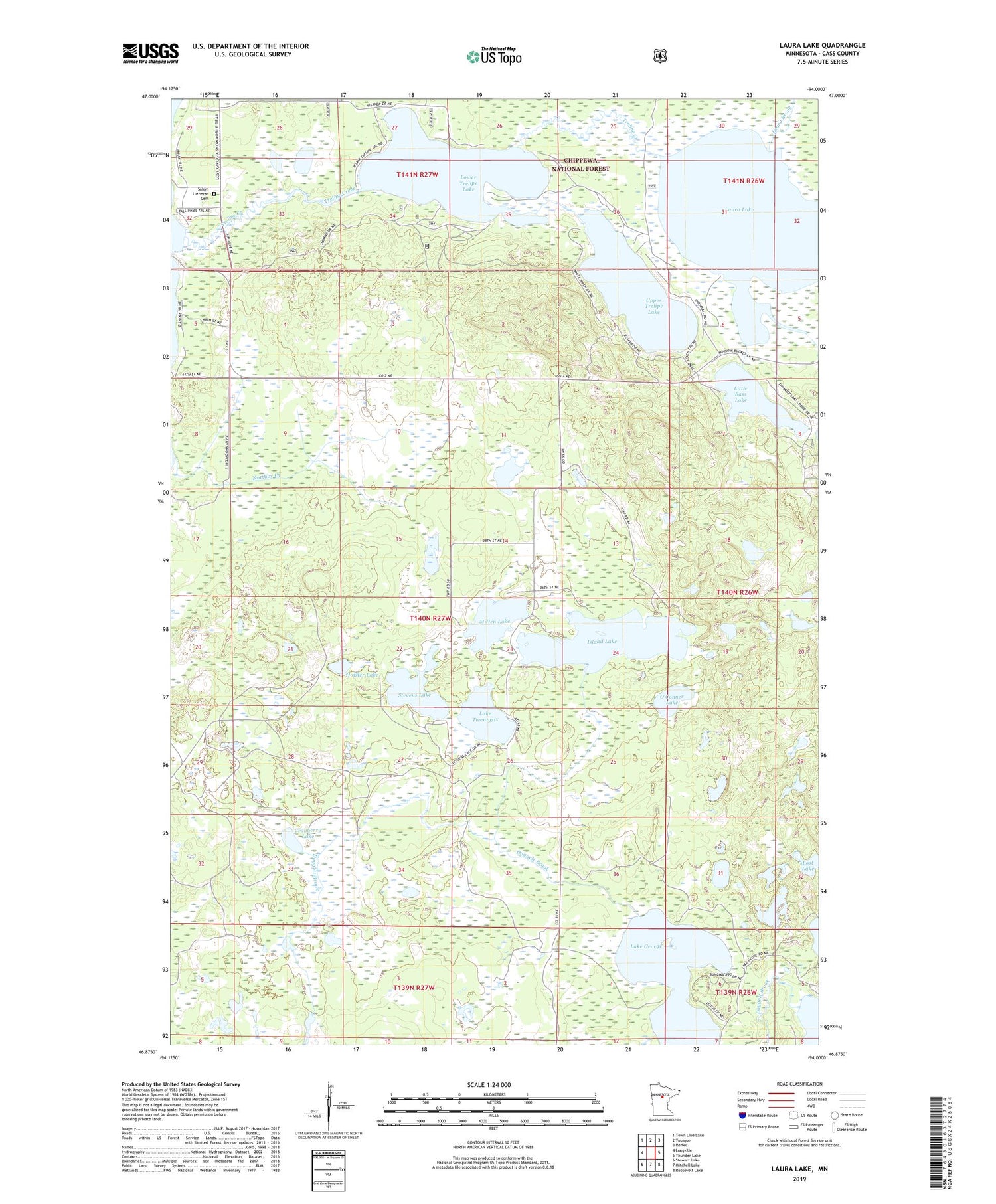
2019 topographic map quadrangle Laura Lake in the state of Minnesota. Scale: 1:24000. Based on the newly updated USGS 7.5' US Topo map series, this map is in the following counties: Cass. The map contains contour data, water features, and other items you are used to seeing on USGS maps, but also has updated roads and other features. This is the next generation of topographic maps. Printed on high-quality waterproof paper with UV fade-resistant inks.
Quads adjacent to this one:
West: Longville
Northwest: Town Line Lake
North: Tobique
Northeast: Remer
East: Thunder Lake
Southeast: Roosevelt Lake
South: Mitchell Lake
Southwest: Stewart Lake
Contains the following named places: Cranberry Lake, Daggett Brook Dam, Daggett Brook Reservoir, Hoister Lake, Island Lake, Lake George, Lake Twentysix, Laura Brook, Laura Lake, Little Bass Lake, Lower Trelipe Lake, Minnesota Chippewa Trust Land, Mitten Lake, Northby Creek, O'Conner Lake, Safe Air Seaplane Base, Salem Lutheran Cemetery, Snowball, Snowball Post Office, Stevens Lake, Township of Trelipe, Trelipe Creek, Upper Trelipe Lake