MyTopo
Sucker Lakes Minnesota US Topo Map
Couldn't load pickup availability
Also explore the Sucker Lakes Forest Service Topo of this same quad for updated USFS data
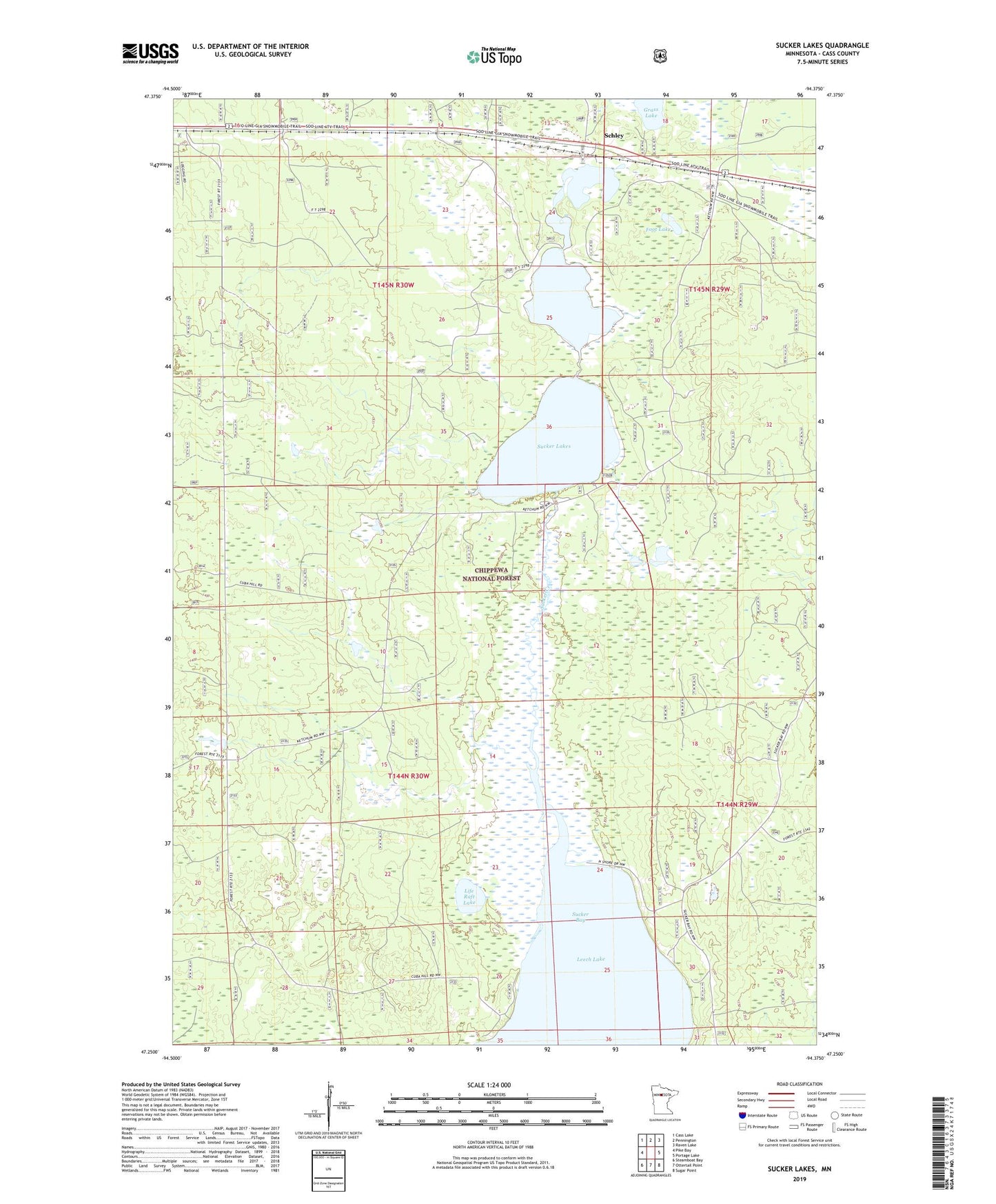
2022 topographic map quadrangle Sucker Lakes in the state of Minnesota. Scale: 1:24000. Based on the newly updated USGS 7.5' US Topo map series, this map is in the following counties: Cass. The map contains contour data, water features, and other items you are used to seeing on USGS maps, but also has updated roads and other features. This is the next generation of topographic maps. Printed on high-quality waterproof paper with UV fade-resistant inks.
Quads adjacent to this one:
West: Pike Bay
Northwest: Cass Lake
North: Pennington
Northeast: Raven Lake
East: Portage Lake
Southeast: Sugar Point
South: Ottertail Point
Southwest: Steamboat Bay
This map covers the same area as the classic USGS quad with code o47094c4.
Contains the following named places: Brush Lake Wildlife Impoundment, Cuba Hill Lookout Tower, Cuba Wildlife Impoundment, Foot Lake, Ketchum Wildlife Impoundment, Life Raft Lake, Middle Sucker Wildlife Impoundment, Schley, Schley Post Office, Sucker Bay Impoundment Dam, Sucker Bay Wildlife Impoundment, Sucker Creek, Sucker Lakes, Township of Otter Tail Peninsula, Winnibigoshish Historical Center