
MyTopo
Sawbill Camp Minnesota US Topo Map
Couldn't load pickup availability
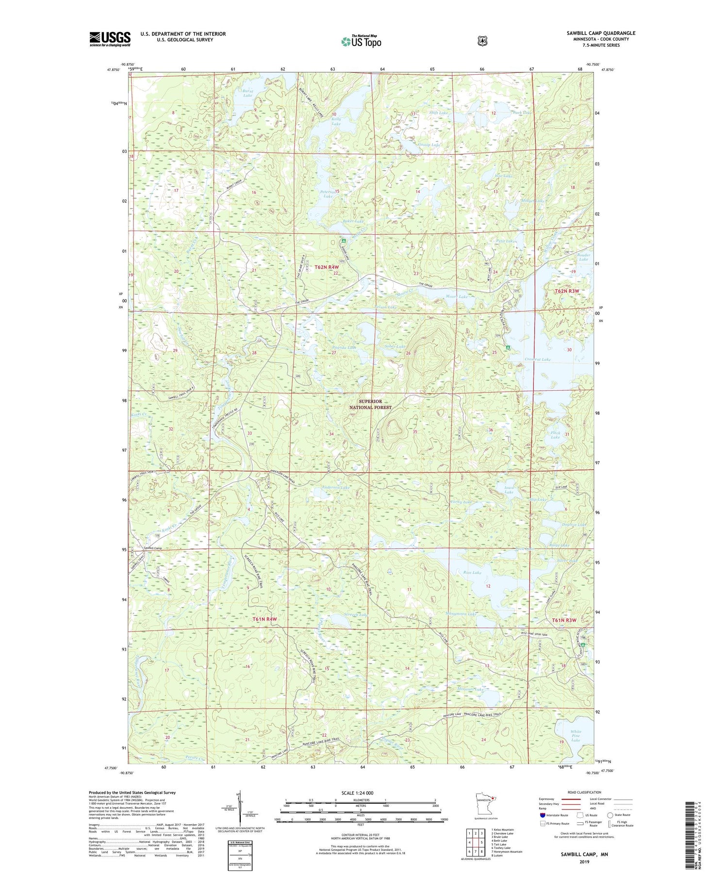
2019 topographic map quadrangle Sawbill Camp in the state of Minnesota. Scale: 1:24000. Based on the newly updated USGS 7.5' US Topo map series, this map is in the following counties: Cook. The map contains contour data, water features, and other items you are used to seeing on USGS maps, but also has updated roads and other features. This is the next generation of topographic maps. Printed on high-quality waterproof paper with UV fade-resistant inks.
Quads adjacent to this one:
West: Beth Lake
Northwest: Kelso Mountain
North: Cherokee Lake
Northeast: Brule Lake
East: Tait Lake
Southeast: Lutsen
South: Honeymoon Mountain
Southwest: Toohey Lake
Contains the following named places: Anderson Lake, Back Lake, Baker Lake, Baker Lake Campground, Bulge Lake, Burnt Creek, Corny Lake, Crescent Lake, Crescent Lake Campground, Dogtrot Lake, Fleck Lake, Gossip Lake, Horn Creek, Horn Lake, Iowa Lake, Kelly Lake, Koski Creek, Manymoon Lake, Marsh Lake, Midget Lake, Missouri Creek, Missouri Lake, Moore Creek, Moore Lake, Nelson Lake, Pagoda Lake, Peterson Lake, Petit Lake, Plouff Creek, Rice Lake, Sawbill Camp, Sawbill Creek, Screech Lake, Shift Lake, Silver Lake, Slip Lake, Sober Lake, Swanson Creek, Tack Lake, Temperance River Lake, Township of Tofte, Wee Lake, Willow Creek


