MyTopo
Shingle Mill Lake Minnesota US Topo Map
Couldn't load pickup availability
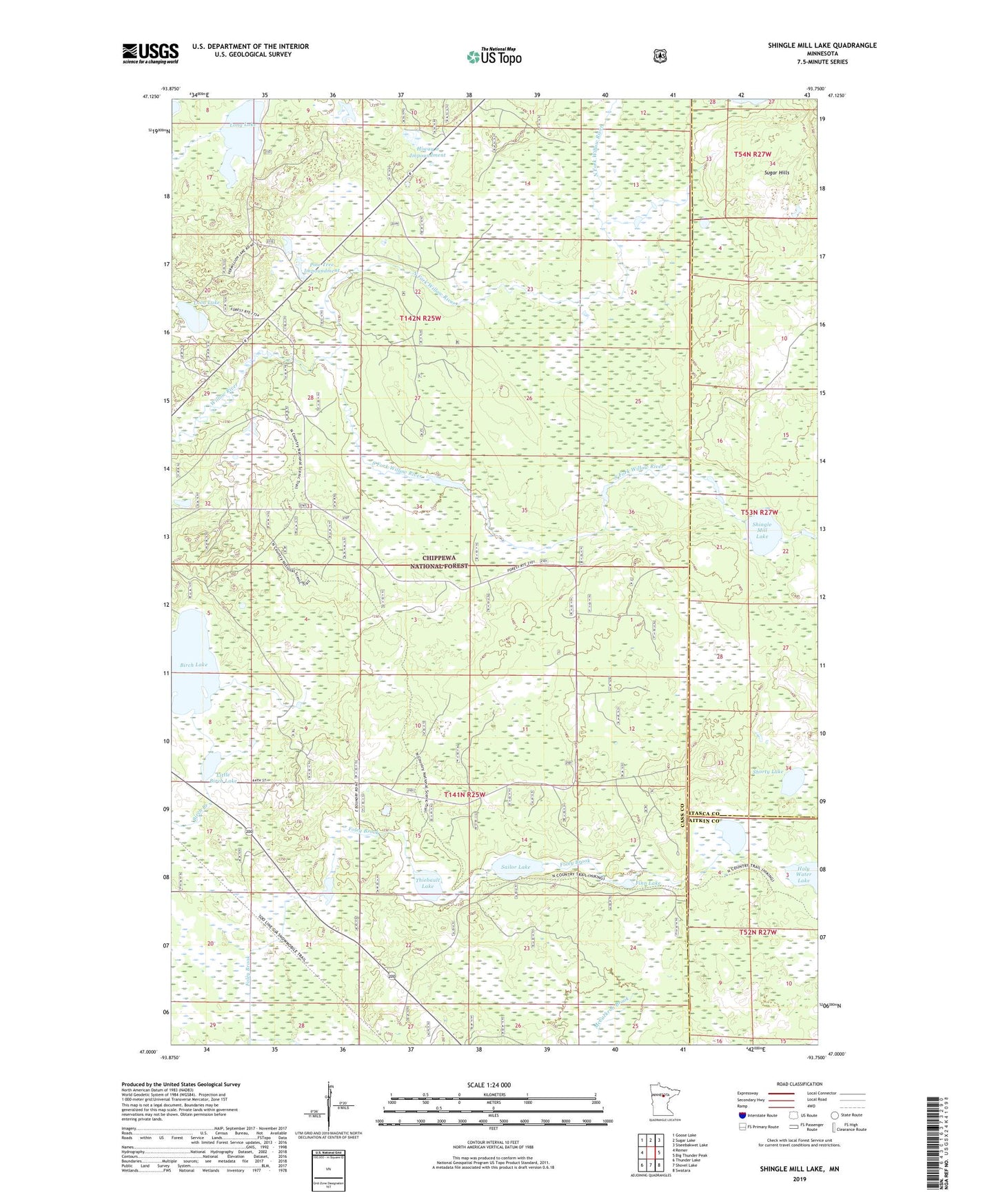
2019 topographic map quadrangle Shingle Mill Lake in the state of Minnesota. Scale: 1:24000. Based on the newly updated USGS 7.5' US Topo map series, this map is in the following counties: Cass, Itasca, Aitkin. The map contains contour data, water features, and other items you are used to seeing on USGS maps, but also has updated roads and other features. This is the next generation of topographic maps. Printed on high-quality waterproof paper with UV fade-resistant inks.
Quads adjacent to this one:
West: Remer
Northwest: Goose Lake
North: Sugar Lake
Northeast: Siseebakwet Lake
East: Big Thunder Peak
Southeast: Swatara
South: Shovel Lake
Southwest: Thunder Lake
Contains the following named places: Birch Lake, Birch Lake Impoundment, Cranberry Lake, Finn Lake, Hiway 6 Impoundment, Little Birch Lake, Long Lake, Loon Lake, Loon Lake Impoundment, North Fork Willow River, Pine Tree Impoundment, Sailor Lake, Shingle Mill Lake, Shorty Lake, South Fork Willow River, Thiebault Lake, Township of Lima, Unorganized Territory of East Cass, Willow River Dam, Willow River Reservoir