MyTopo
Wabasso SW Minnesota US Topo Map
Couldn't load pickup availability
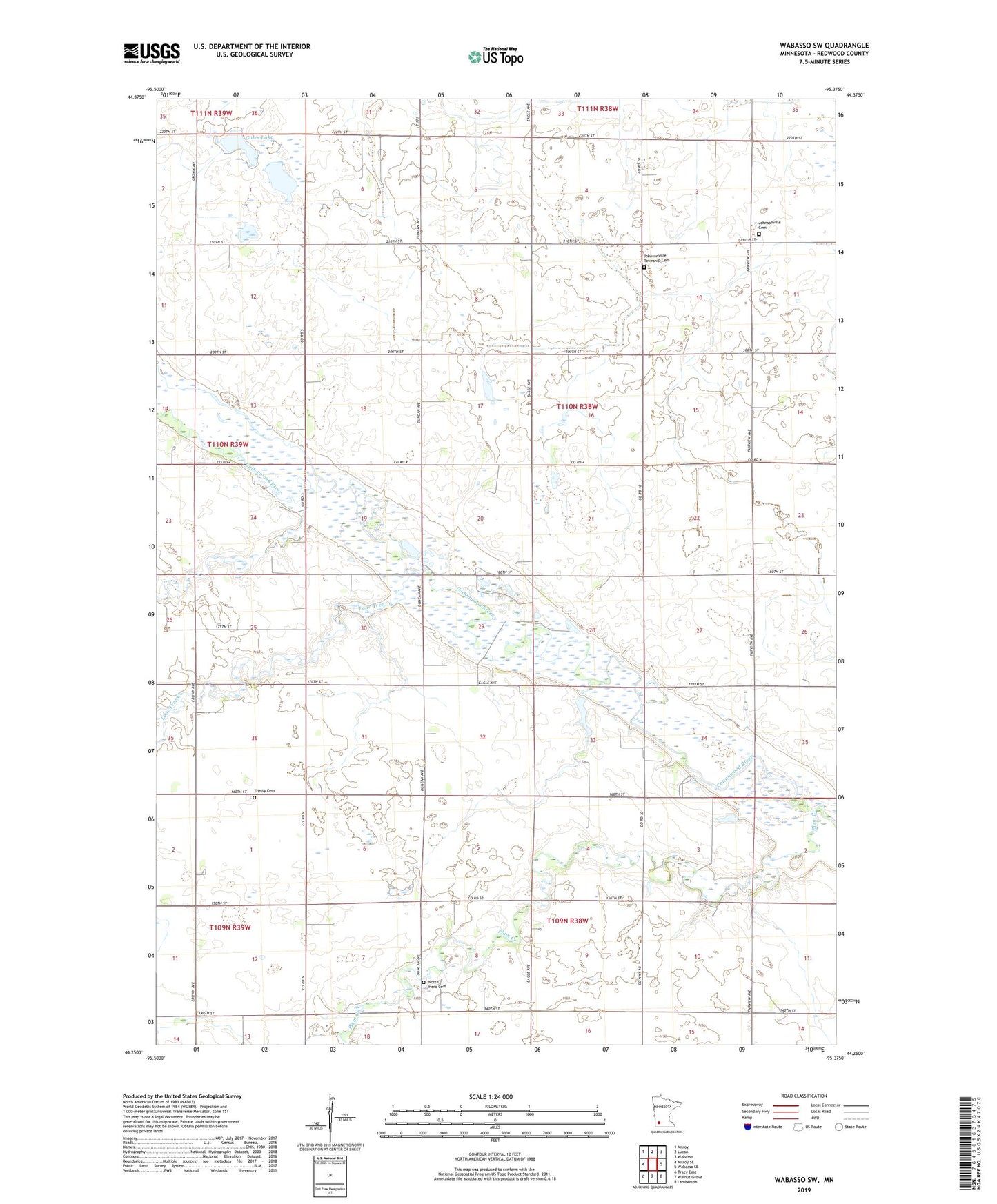
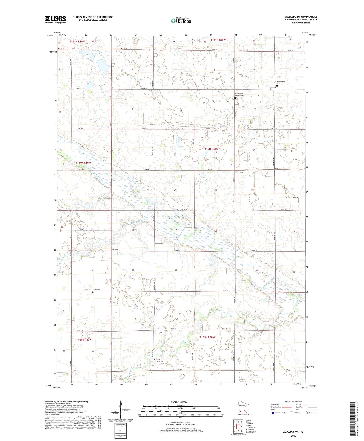
2019 topographic map quadrangle Wabasso SW in the state of Minnesota. Scale: 1:24000. Based on the newly updated USGS 7.5' US Topo map series, this map is in the following counties: Redwood. The map contains contour data, water features, and other items you are used to seeing on USGS maps, but also has updated roads and other features. This is the next generation of topographic maps. Printed on high-quality waterproof paper with UV fade-resistant inks.
Quads adjacent to this one:
West: Milroy SE
Northwest: Milroy
North: Lucan
Northeast: Wabasso
East: Wabasso SE
Southeast: Lamberton
South: Walnut Grove
Southwest: Tracy East
Contains the following named places: Arlen Knott Detention Dam, Duane Knott Retention Reservoir Dam, Gales Lake, Gales State Wildlife Management Area, Johnsonville Cemetery, Johnsonville Church, Johnsonville Township Cemetery, Lone Tree Creek, North Hero Cemetery, Plum Creek, Township of Johnsonville, Trinity Cemetery