MyTopo
Tracy East Minnesota US Topo Map
Couldn't load pickup availability
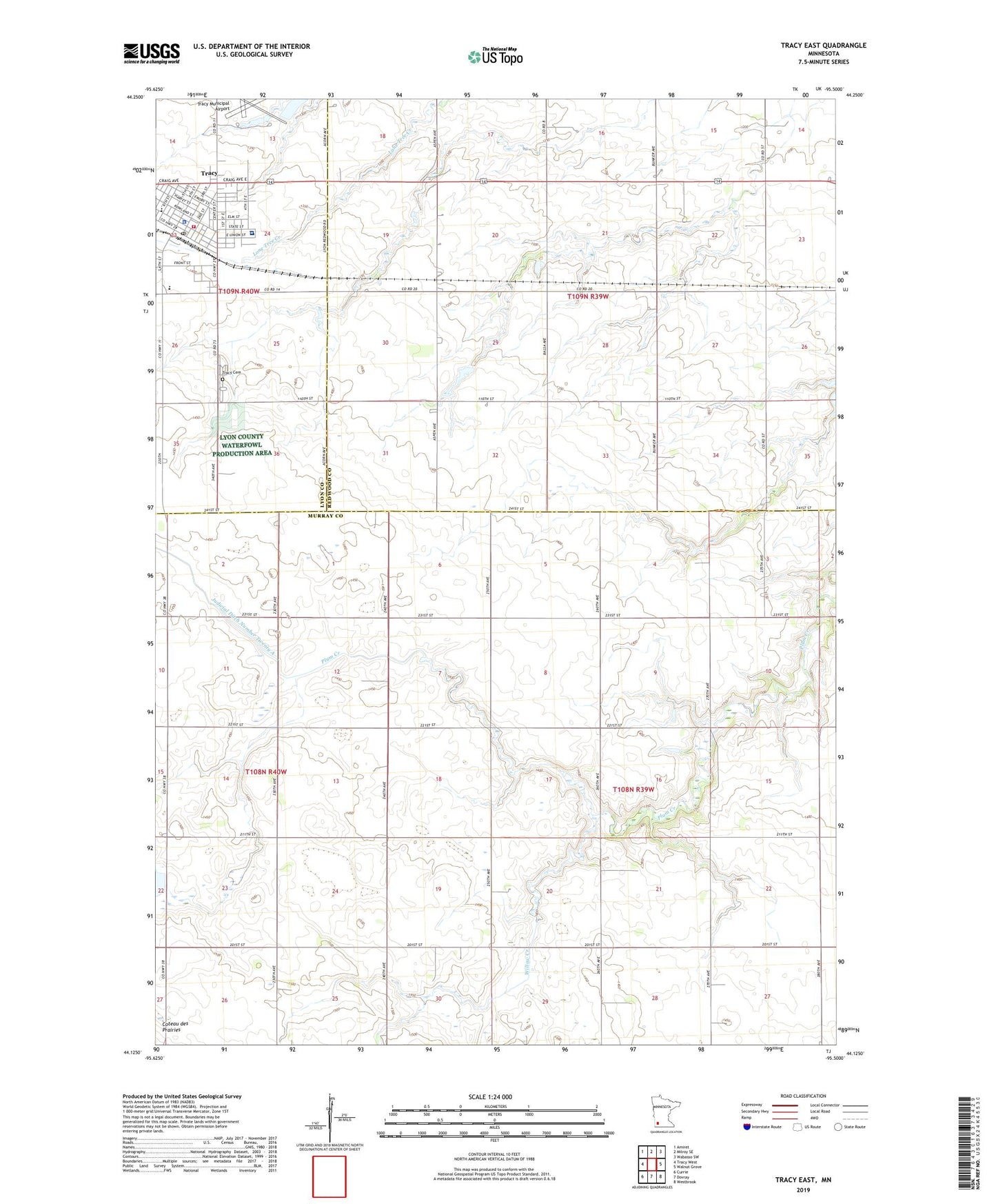
2022 topographic map quadrangle Tracy East in the state of Minnesota. Scale: 1:24000. Based on the newly updated USGS 7.5' US Topo map series, this map is in the following counties: Murray, Redwood, Lyon. The map contains contour data, water features, and other items you are used to seeing on USGS maps, but also has updated roads and other features. This is the next generation of topographic maps. Printed on high-quality waterproof paper with UV fade-resistant inks.
Quads adjacent to this one:
West: Tracy West
Northwest: Amiret
North: Milroy SE
Northeast: Wabasso SW
East: Walnut Grove
Southeast: Westbrook
South: Dovray
Southwest: Currie
This map covers the same area as the classic USGS quad with code o44095b5.
Contains the following named places: Cedar Lane Trailer Park, Christian Alliance Church, Church of Christ, City of Tracy, East Side Park, First Presbyterian Church, Holly Church, Judicial Ditch Number Twentyeight, Lions Wayside Park, Phil Draayum Pond Dam, Saint Mary's Catholic Church, Saint Mary's Catholic School, Sanford Tracy Medical Center, Township of Holly, Township of Springdale, Tracy, Tracy Ambulance, Tracy Cemetery, Tracy City Park, Tracy Country Club, Tracy Fire Department, Tracy Grade School, Tracy Lutheran Church, Tracy Medical Clinic, Tracy Municipal Airport, Tracy Nursing Home, Tracy Police Department, Tracy Post Office, Tracy Public Library, Tracy United Methodist Church, Travelers Park, Werner Park, Willow Creek, Zion Lutheran Church