MyTopo
Wilson Lake Minnesota US Topo Map
Couldn't load pickup availability
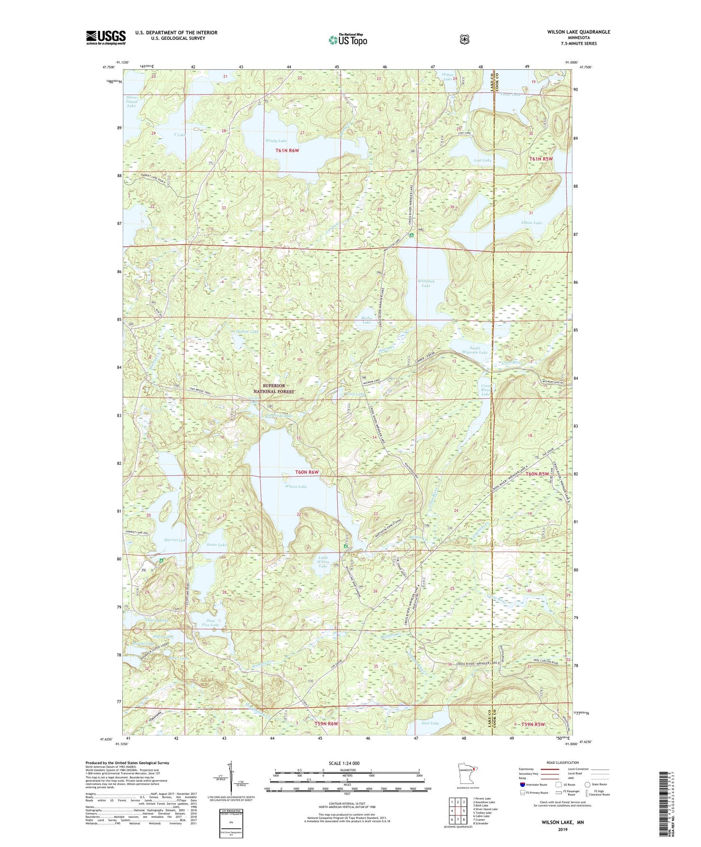
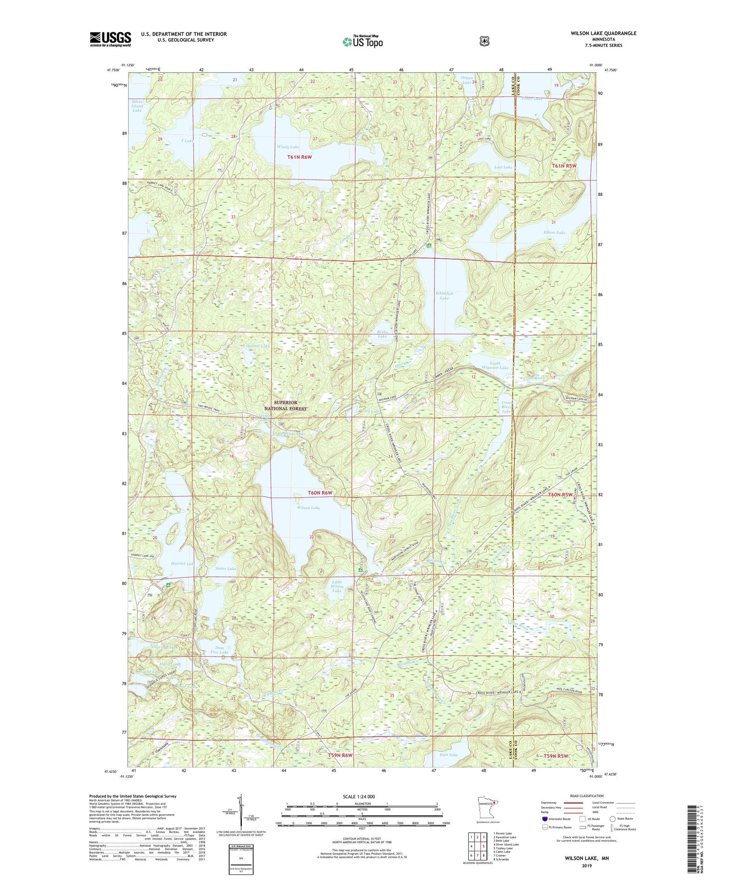
2019 topographic map quadrangle Wilson Lake in the state of Minnesota. Scale: 1:24000. Based on the newly updated USGS 7.5' US Topo map series, this map is in the following counties: Lake, Cook. The map contains contour data, water features, and other items you are used to seeing on USGS maps, but also has updated roads and other features. This is the next generation of topographic maps. Printed on high-quality waterproof paper with UV fade-resistant inks.
Quads adjacent to this one:
West: Silver Island Lake
Northwest: Perent Lake
North: Kawishiwi Lake
Northeast: Beth Lake
East: Toohey Lake
Southeast: Schroeder
South: Cramer
Southwest: Cabin Lake
Contains the following named places: Alger Lake, Beany Creek, Besho Lake, Charity Lake, Cross River Lake, Cross River Number Three Dam, Dam Five Lake, Dam Five Lake Dam, East Lake, Elbow Lake, Fourmile Creek, Frear Lake, Fulton Creek, Gertrude Lake, Harriet Lake, Harry Creek, Houghtaling Creek, Landa Creek, Little Wilson Lake, Lost Lake, Mound Lake, North Wigwam Lake, Organ Lake, Outlaw Lake, Sister Lake, South Wigwam Lake, Steer Lake, T Lake, Tord Creek, Tord Lake, Unorganized Territory of Lake Number 1, Vivian Lake, Wanless, Wanless Creek, Whitefish Lake, Wigwam Lake, Wilson Creek, Wilson Lake, Wilson Lake Dam, Windy Lake