MyTopo
Wykoff Minnesota US Topo Map
Couldn't load pickup availability
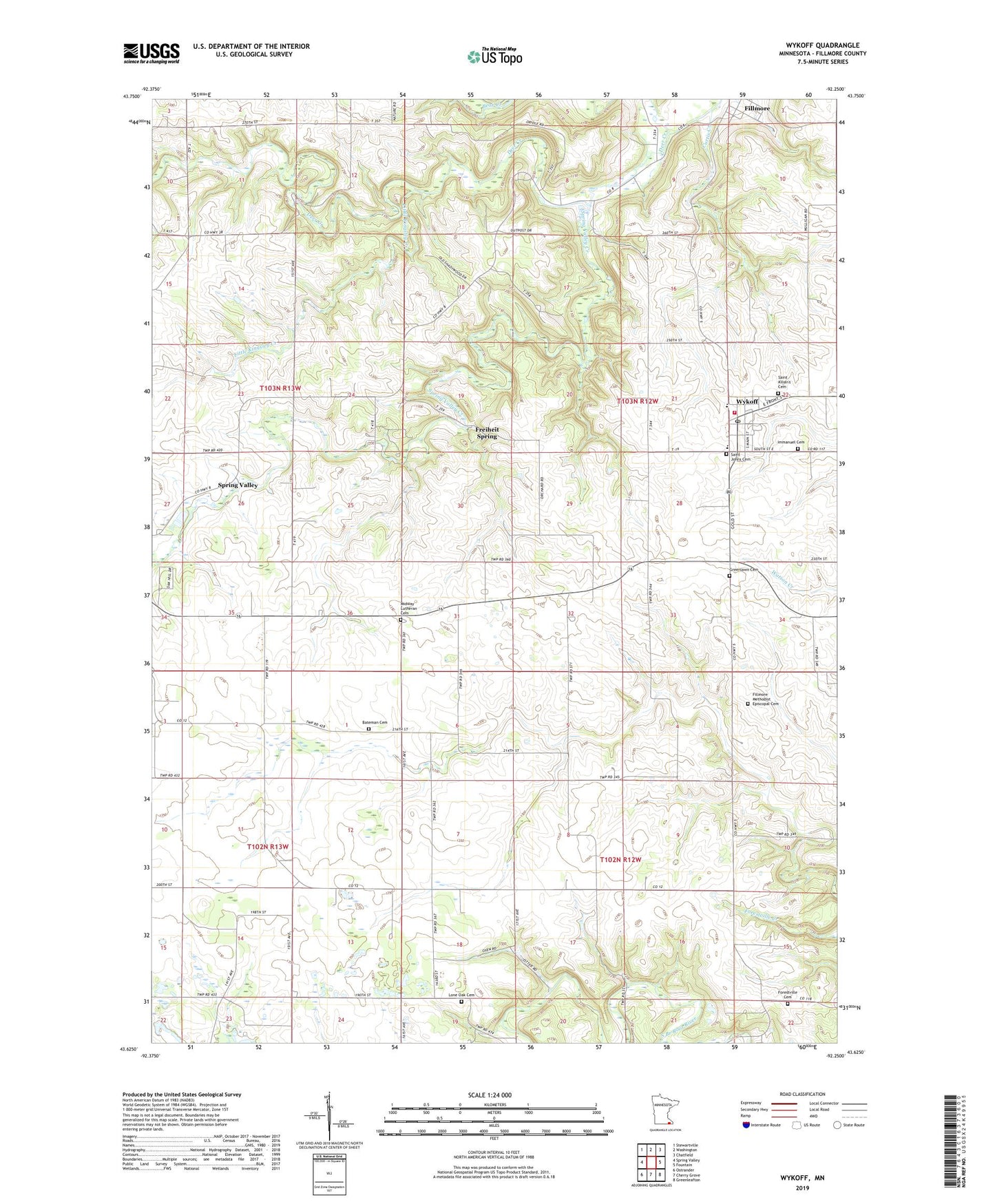
2019 topographic map quadrangle Wykoff in the state of Minnesota. Scale: 1:24000. Based on the newly updated USGS 7.5' US Topo map series, this map is in the following counties: Fillmore. The map contains contour data, water features, and other items you are used to seeing on USGS maps, but also has updated roads and other features. This is the next generation of topographic maps. Printed on high-quality waterproof paper with UV fade-resistant inks.
Quads adjacent to this one:
West: Spring Valley
Northwest: Stewartville
North: Washington
Northeast: Chatfield
East: Fountain
Southeast: Greenleafton
South: Cherry Grove
Southwest: Ostrander
Contains the following named places: Bateman Cemetery, Bateman School, Bear Creek, Christian Heritage School, City of Wykoff, Curtis Creek, Deer Creek, Fillmore, Fillmore Free Methodist Church, Fillmore Methodist Episcopal Cemetery, Fillmore Post Office, Forestville Cemetery, Freiheit Spring, Immanuel Cemetery, Immanuel Lutheran Church, Kingsland Middle School, Little Kingsley Creek, Lone Oak Cemetery, Martin Luther Church, Masonic Park, Meighen Store Historical Marker, Midway Lutheran Cemetery, Minnesota Memorial Hardwood State Forest, Saint Johns Cemetery, Saint John's Church, Saint John's Lutheran School, Saint Kilian's Cemetery, Spring Valley Creek, Township of Forestville, United Methodist Church, Wykoff, Wykoff Cemetery, Wykoff Fire Department, Wykoff Mobile Home Park I, Wykoff Mobile Home Park II, Wykoff Post Office, ZIP Codes: 55975, 55990