MyTopo
Brewer Mississippi US Topo Map
Couldn't load pickup availability
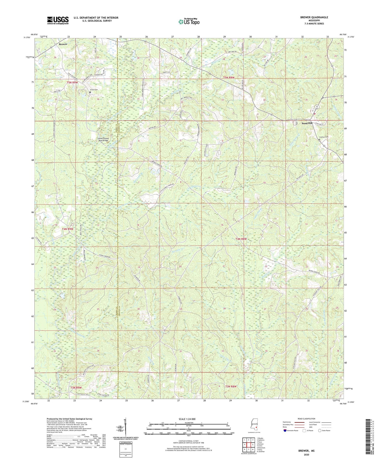
2024 topographic map quadrangle Brewer in the state of Mississippi. Scale: 1:24000. Based on the newly updated USGS 7.5' US Topo map series, this map is in the following counties: Greene, Perry. The map contains contour data, water features, and other items you are used to seeing on USGS maps, but also has updated roads and other features. This is the next generation of topographic maps. Printed on high-quality waterproof paper with UV fade-resistant inks.
Quads adjacent to this one:
West: Richton
Northwest: Rhodes
North: Mulberry
Northeast: Piave
East: Avera
Southeast: Jonathan
South: Neely
Southwest: Beaumont
This map covers the same area as the classic USGS quad with code o31088c7.
Contains the following named places: Avera Church, Beetree Creek, Boykin Creek, Brewer, Brewer School, Fivemile Creek, Freeman School, Frisco Cemetery, Gaines Brewer Road Bridge, Grafton Cemetery, Little Gaines Creek, Long Branch, Lower Flat Branch, Nazareth Church, Newcomb Branch, Piney Woods Creek, Sand Hill, Sand Hill Baptist Church, Sand Hill Creek, Sand Hill Creek Church, Sand Hill Volunteer Fire Department, Supervisor District 3, Upper Flat Branch, Yellow Jacket Branch, Zion Rest Church