MyTopo
Mulberry Mississippi US Topo Map
Couldn't load pickup availability
Also explore the Mulberry Forest Service Topo of this same quad for updated USFS data
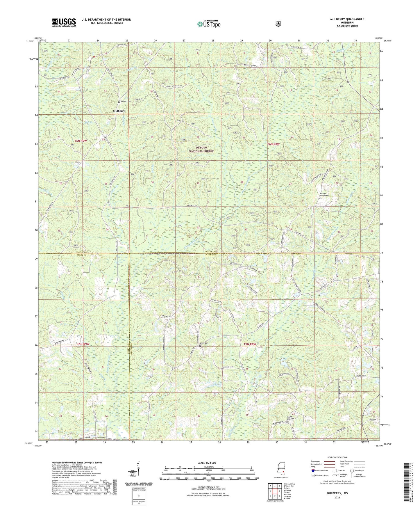
2024 topographic map quadrangle Mulberry in the state of Mississippi. Scale: 1:24000. Based on the newly updated USGS 7.5' US Topo map series, this map is in the following counties: Wayne, Greene, Perry. The map contains contour data, water features, and other items you are used to seeing on USGS maps, but also has updated roads and other features. This is the next generation of topographic maps. Printed on high-quality waterproof paper with UV fade-resistant inks.
Quads adjacent to this one:
West: Rhodes
Northwest: Strengthford
North: Water Oak
Northeast: Clara
East: Piave
Southeast: Avera
South: Brewer
Southwest: Richton
This map covers the same area as the classic USGS quad with code o31088d7.
Contains the following named places: Fellowship Free Will Baptist Church, Gator Branch, Gunstock Branch, Hall Branch, Henderson, Hickory Grove Cemetery, J R Stinson Lake Dam, Lovewell Church, Mohlenoff Pond Dam, Mount Zion Cemetery, Mount Zion Church, Mulberry, Mulberry Cemetery, Mulberry Church, New Lovewell Church, Okey Branch, Pineview Church, Spring Branch, Union Cemetery, Union Grove Church, Union School, Wayne County Volunteer Fire Department Mulberry - Corinth Station, ZIP Code: 39476