MyTopo
Tutwiler Mississippi US Topo Map
Couldn't load pickup availability
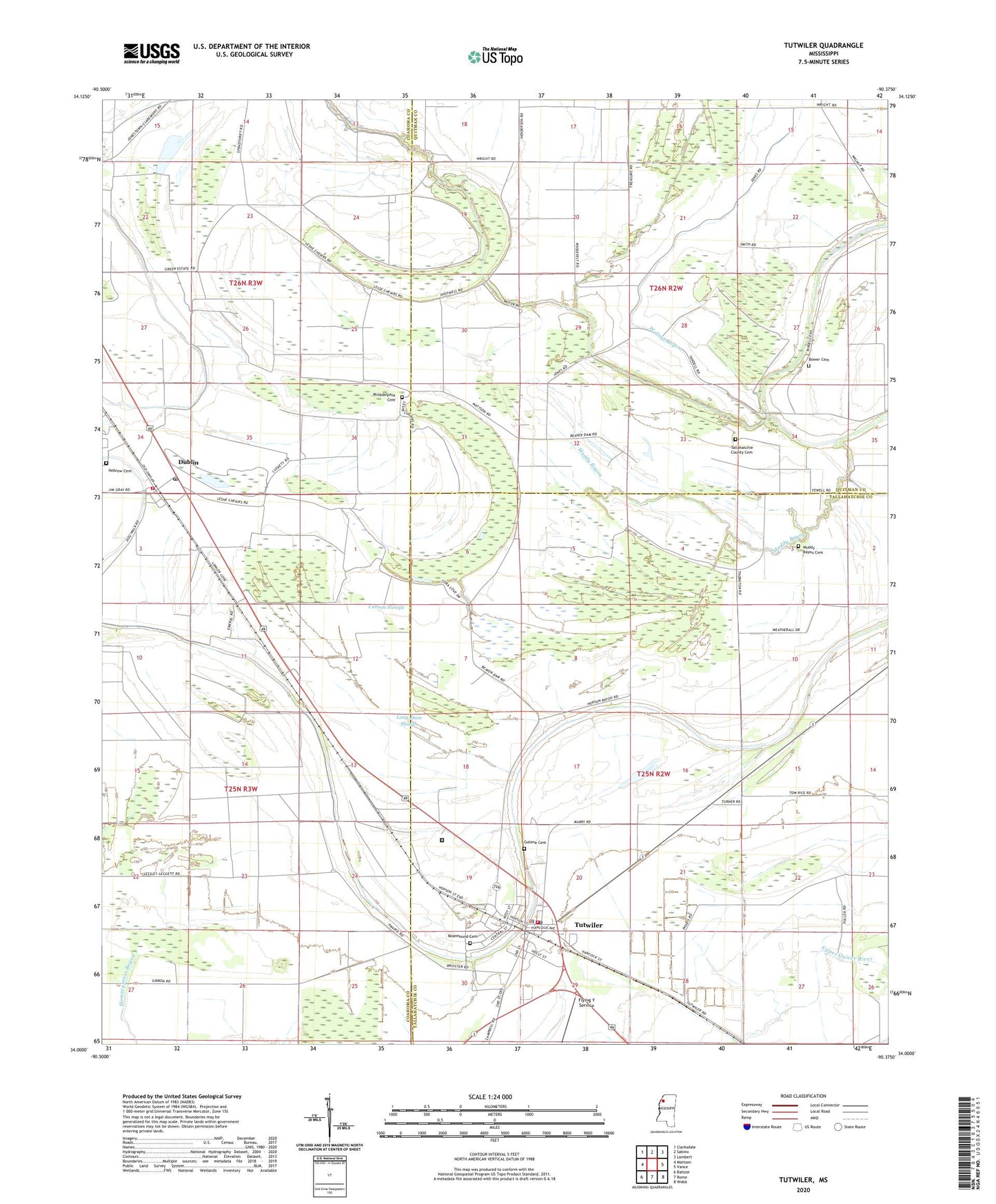
2024 topographic map quadrangle Tutwiler in the state of Mississippi. Scale: 1:24000. Based on the newly updated USGS 7.5' US Topo map series, this map is in the following counties: Coahoma, Tallahatchie, Quitman. The map contains contour data, water features, and other items you are used to seeing on USGS maps, but also has updated roads and other features. This is the next generation of topographic maps. Printed on high-quality waterproof paper with UV fade-resistant inks.
Quads adjacent to this one:
West: Mattson
Northwest: Clarksdale
North: Sabino
Northeast: Lambert
East: Vance
Southeast: Webb
South: Rome
Southwest: Baltzer
This map covers the same area as the classic USGS quad with code o34090a4.
Contains the following named places: Arcadia Plantation, Bower Cemetery, Carson Slough, Cedar Grove Church, Coahoma County Volunteer Fire Department Dublin, County Line Church, Cunningham Church, Cypress Lake, Cypress Pond, Dry Lake, Dublin, Dublin Census Designated Place, Dublin Post Office, Dublin School, Elm Grove Church, Fitch, Flying Y Service, Galena Cemetery, Hebrew Cemetery, Hebrew Church, Holly Grove Church, Hopson Bayou Elementary School, Long Dam Slough, Miller School, Mount Eagle Church, Mount Moriah Church, Muddy Bayou, Muddy Bayou Cemetery, New Bethel Church, New Galilee Church, Palestine Church, Philadelphia Cemetery, Philadelphia School, Popsons, Rosemound Cemetery, Saint Marys Church, Stillons, Strong Chapel, Tallahatchie County Cemetery, Tallahatchie County Correctional Facility, The Dam, Thomas Chapel, Thompson Chapel, Town of Tutwiler, Tutwiler, Tutwiler Baptist Church, Tutwiler Elementary School, Tutwiler Police Department, Tutwiler Post Office, Tutwiler Volunteer Fire Department, Walnut Bayou, Whitfield Church, Wrights Chapel Church of God and Christ, ZIP Codes: 38963, 38964