MyTopo
Chipola Louisiana US Topo Map
Couldn't load pickup availability
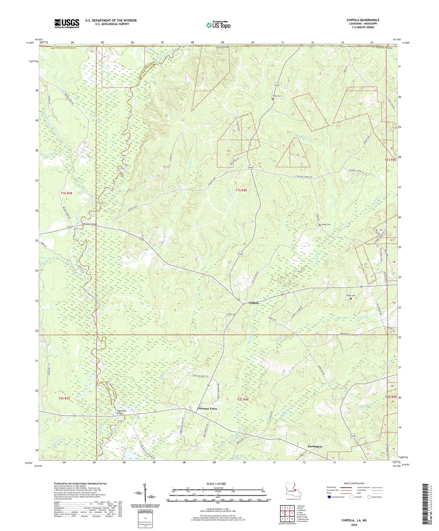
2024 topographic map quadrangle Chipola in the state of Louisiana. Scale: 1:24000. Based on the newly updated USGS 7.5' US Topo map series, this map is in the following counties: St. Helena, East Feliciana, Amite. The map contains contour data, water features, and other items you are used to seeing on USGS maps, but also has updated roads and other features. This is the next generation of topographic maps. Printed on high-quality waterproof paper with UV fade-resistant inks.
Quads adjacent to this one:
West: Felps
Northwest: Berwick
North: Street
Northeast: Gillsburg
East: Liverpool
Southeast: Greensburg
South: Hatchersville
Southwest: Bluff Creek
Contains the following named places: Beaver Creek, Black Creek Church, Buck Creek, Channey Creek, Chipola, Clear Creek, Coleman Town, Collins Creek, Darlington, Dry Branch, East Fork Amite River, Hurst Cemetery, Joiner Creek, Kemp Cemetery, Little River, McAdam Bridge, Mitchell Church, Parish Governing Authority District 1, Riverside Church, Saint Helena Church, Saint Marys Branch, Sandy Run, South Sandy Run, Spring Branch, Thompson Bridge, Turkey Creek, Wales Cemetery, West Fork Amite River, Woodland Creek