MyTopo
Beulah Mississippi US Topo Map
Couldn't load pickup availability
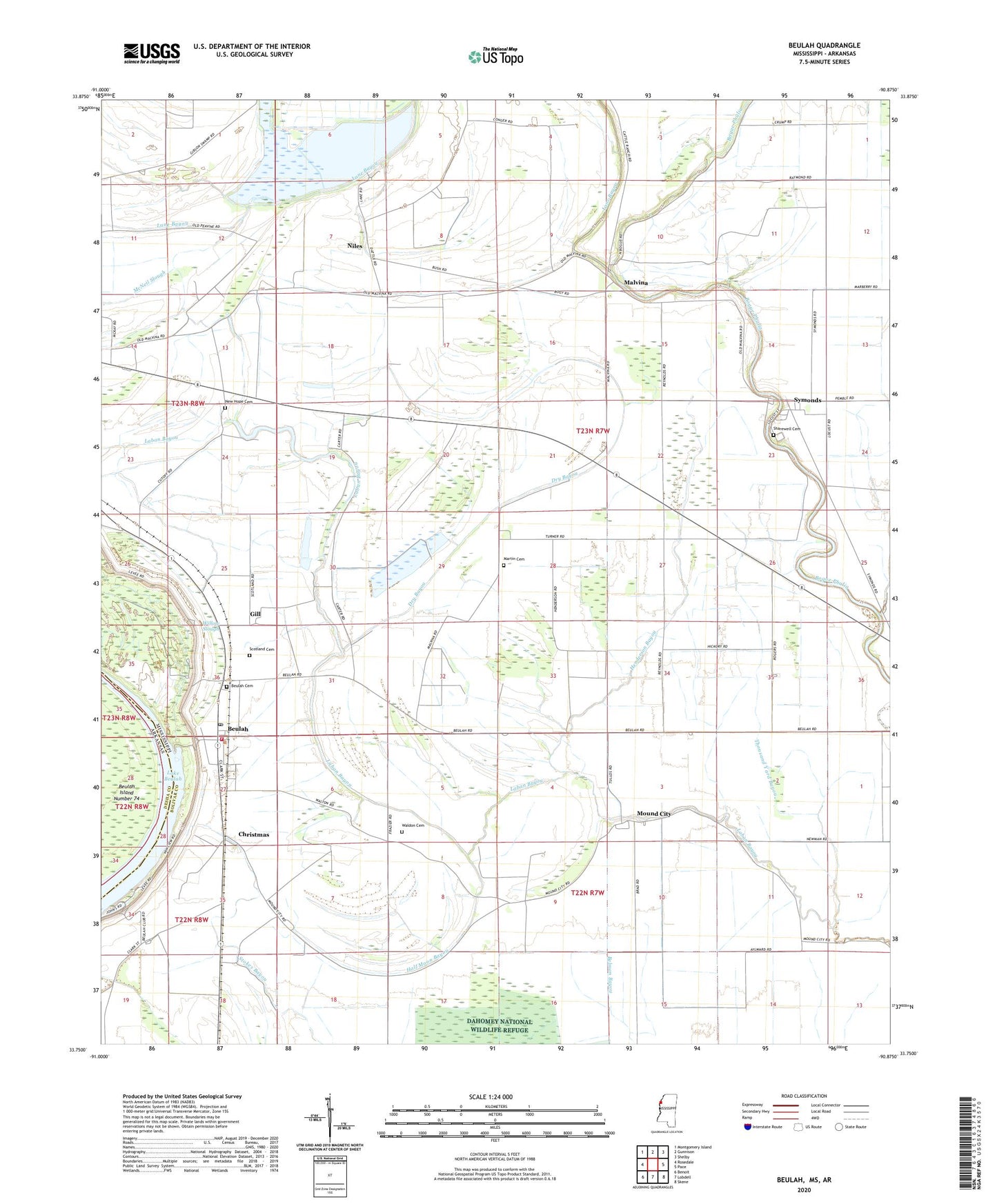
2020 topographic map quadrangle Beulah in the state of Mississippi. Scale: 1:24000. Based on the newly updated USGS 7.5' US Topo map series, this map is in the following counties: Bolivar, Desha. The map contains contour data, water features, and other items you are used to seeing on USGS maps, but also has updated roads and other features. This is the next generation of topographic maps. Printed on high-quality waterproof paper with UV fade-resistant inks.
Quads adjacent to this one:
West: Rosedale
Northwest: Montgomery Island
North: Gunnison
Northeast: Shelby
East: Pace
Southeast: Skene
South: Lobdell
Southwest: Benoit
Contains the following named places: Bethlehem Church, Beulah, Beulah Cemetery, Beulah Fire Department, Beulah Post Office, Bob Malone Catfish Ponds Dam, Bold Pilgrim Church, Boles Lake, Bolivar County, Chenault Farms, Christmas, Clifford, Conservation Lake Dam, Conservation League Lake, Ditch Number Nine, Ditch Number Seven, Ditch Number Thirteen, Ditch Number Three, Ditch Number Twelve, Ditch Number Twelve A, Ditch Number Two, Dry Bayou, Gill, Goffs Bayou, Half Moon Bayou, Henderson Bayou, Lane Bayou, Living Hope Church, Malvina, Martin Cemetery, Morning Star Church, Mound City, Mount Pleasant Church, New Hope Cemetery, New Hope Church, Niles, Peters Rock Church, Pitts Chapel, Pleasant Grove Church, Rock of Ages Church, Saint Andrews Church, Scotland Cemetery, Scotland Plantation, Sharewell Cemetery, Sugar Hill Plantation, Supervisor District 1, Symonds, Symonds Census Designated Place, Thousand Yard Bayou, Town of Beulah, Waldon Cemetery, Willow Slough, ZIP Codes: 38726, 38769