MyTopo
Boon Mississippi US Topo Map
Couldn't load pickup availability
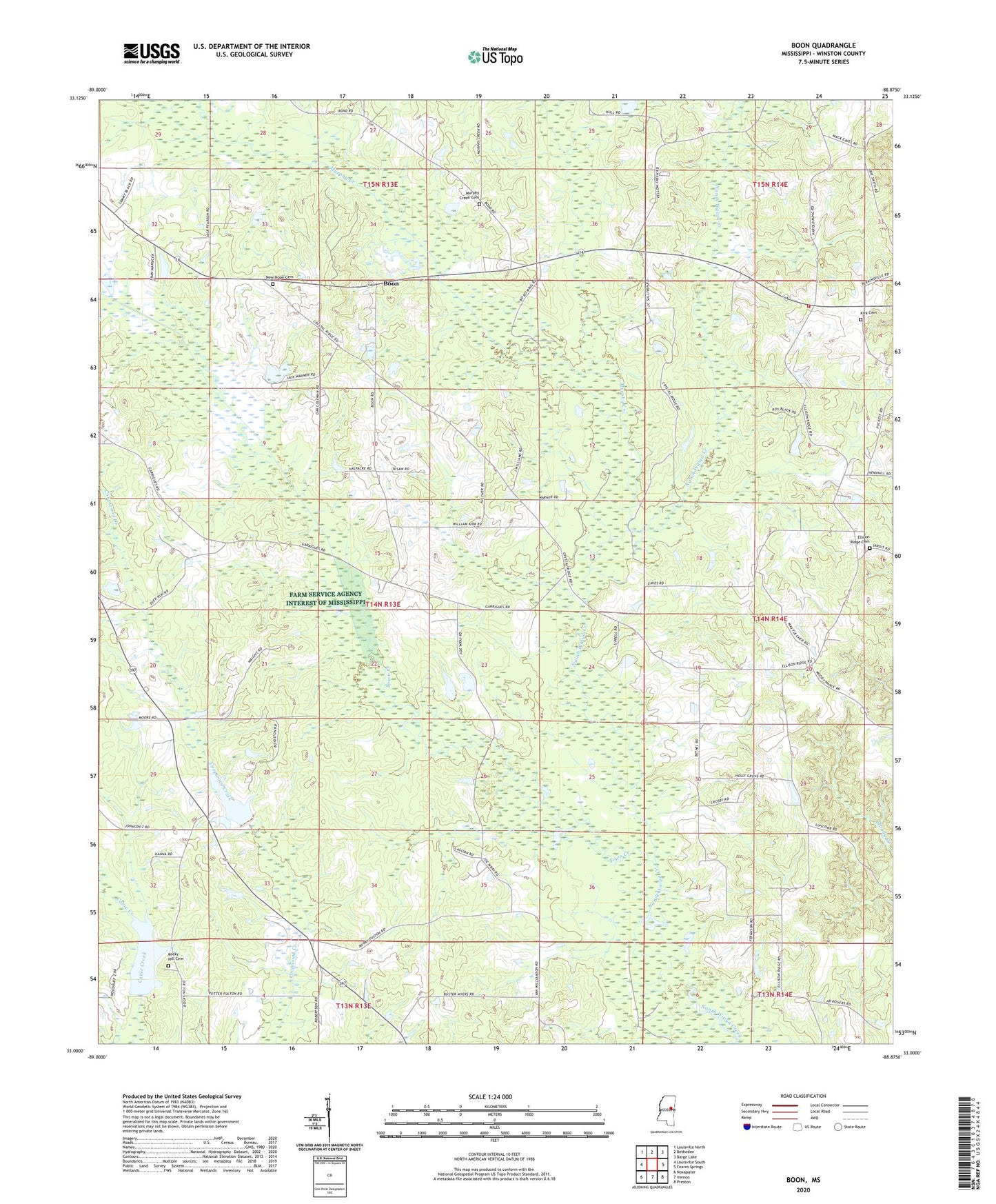
2020 topographic map quadrangle Boon in the state of Mississippi. Scale: 1:24000. Based on the newly updated USGS 7.5' US Topo map series, this map is in the following counties: Winston. The map contains contour data, water features, and other items you are used to seeing on USGS maps, but also has updated roads and other features. This is the next generation of topographic maps. Printed on high-quality waterproof paper with UV fade-resistant inks.
Quads adjacent to this one:
West: Louisville South
Northwest: Louisville North
North: Betheden
Northeast: Barge Lake
East: Fearns Springs
Southeast: Preston
South: Vernon
Southwest: Noxapater
Contains the following named places: Bethel Church, Boon, Crystal Ridge Church, Crystal Ridge Indian Reservation, East Winston Volunteer Fire Department, Ellison Ridge, Ellison Ridge Cemetery, Ellison Ridge Church, Kirk Family Cemetery, Murphy Creek, Murphy Creek Baptist Church Cemetery, Murphy Creek Church, New Hope Church, New Hope Methodist Church Cemetery, Randalls Bluff, Reed Lake, Rocky Hill Church, Rocky Hill United Methodist Church Cemetery, Supervisor District 2, Tallahaga Creek Watershed Structure 12 Dam, Tallahaga Creek Watershed Structure 13 Dam, Town Creek, Town Creek Canal, Zion Chapel