MyTopo
Denham Mississippi US Topo Map
Couldn't load pickup availability
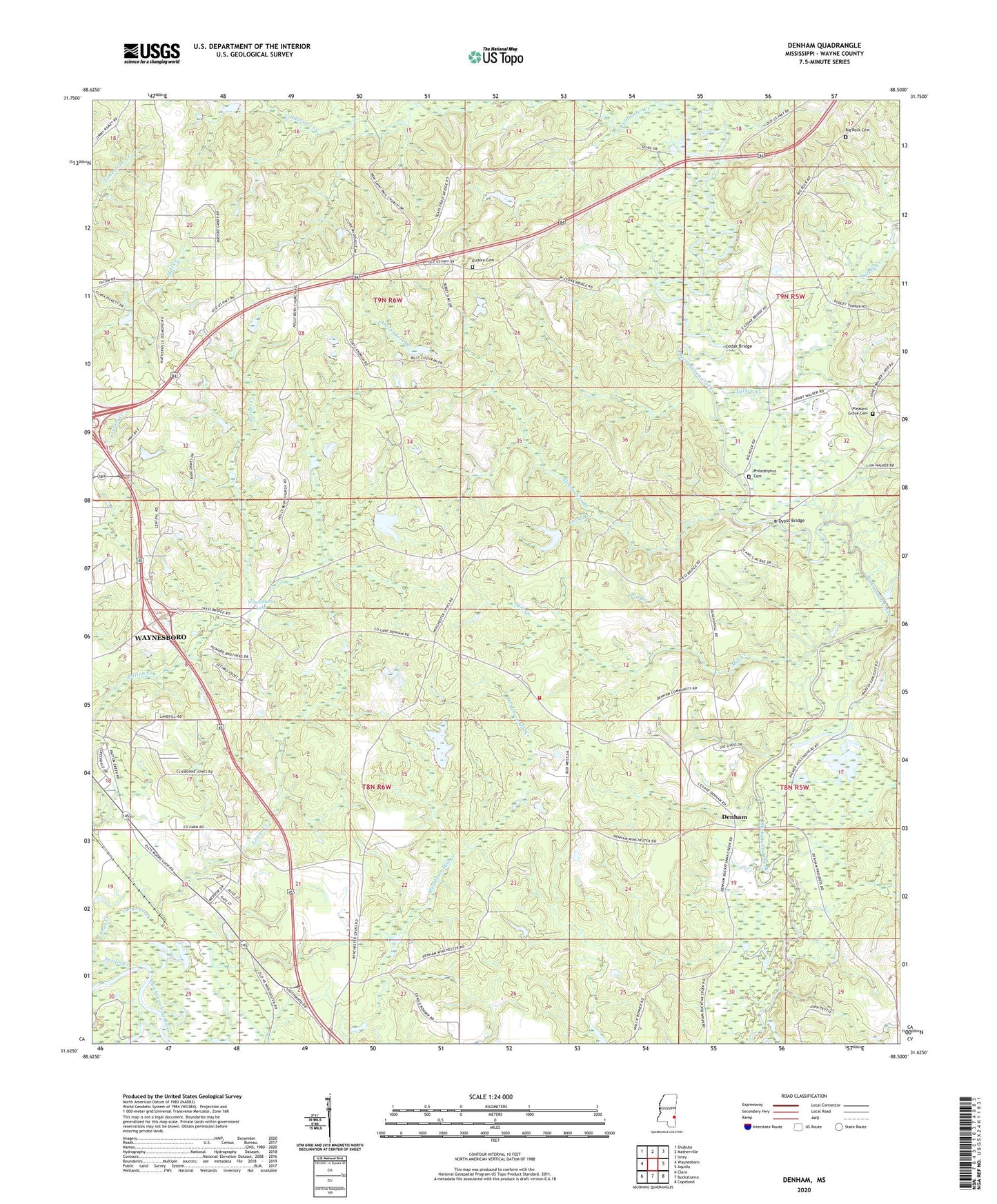
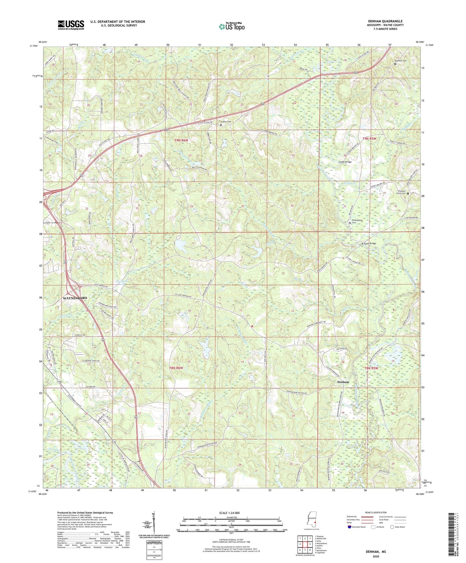
2024 topographic map quadrangle Denham in the state of Mississippi. Scale: 1:24000. Based on the newly updated USGS 7.5' US Topo map series, this map is in the following counties: Wayne. The map contains contour data, water features, and other items you are used to seeing on USGS maps, but also has updated roads and other features. This is the next generation of topographic maps. Printed on high-quality waterproof paper with UV fade-resistant inks.
Quads adjacent to this one:
West: Waynesboro
Northwest: Shubuta
North: Matherville
Northeast: Isney
East: Aquilla
Southeast: Copeland
South: Buckatunna
Southwest: Clara
This map covers the same area as the classic USGS quad with code o31088f5.
Contains the following named places: Alexanders Branch, Antioch Church, Big Branch, Big Rock Cemetery, Big Rock Church, Cedar Bridge, Chapel Hill Church, Clark Pond Dam, Coldwater Creek, Denham, Denham School, Dyess Bridge, East Shady Grove Church, Ellis Lake Dam, Eudora Cemetery, Fedora, Fedora Methodist Church, Holly Bush Church, Langs Creek, Macks School, Maynor Creek Water Park Dam, Mill Creek, New Saint Paul Church, Palmer Ponds Dam, Patton Creek, Philadelphus Cemetery, Philadelphus Church, Pine Grove Church, Pleasant Grove Cemetery, Pleasant Grove Church, Pond Branch, Robinsons Store, Supervisor District 2, Tokio, Turkey Creek, Wayne County Farm, Wayne County Volunteer Fire Department Denham Station, Waynesboro Lake, Waynesboro Lake Dam, Winchester Oil Field