MyTopo
Post Mississippi US Topo Map
Couldn't load pickup availability
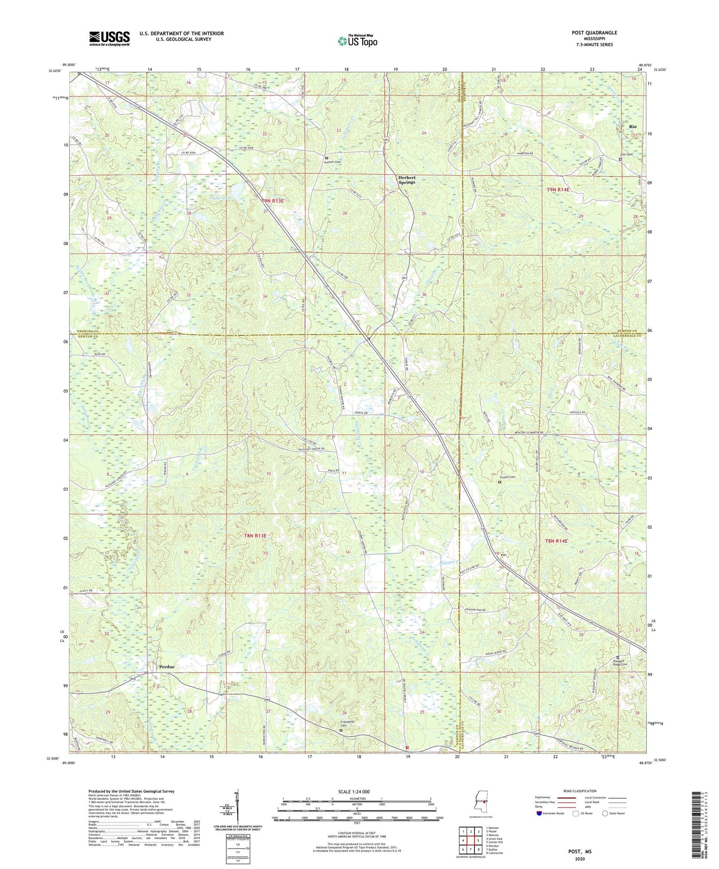
2024 topographic map quadrangle Post in the state of Mississippi. Scale: 1:24000. Based on the newly updated USGS 7.5' US Topo map series, this map is in the following counties: Newton, Neshoba, Lauderdale, Kemper. The map contains contour data, water features, and other items you are used to seeing on USGS maps, but also has updated roads and other features. This is the next generation of topographic maps. Printed on high-quality waterproof paper with UV fade-resistant inks.
Quads adjacent to this one:
West: Union East
Northwest: Deemer
North: House
Northeast: Moscow
East: Center Hill
Southeast: Collinsville
South: Duffee
Southwest: Decatur
This map covers the same area as the classic USGS quad with code o32088e8.
Contains the following named places: Alawine Springs Church, Antioch Cemetery, Antioch Church, Battlefield, Battlefield School, Bethel Church, Big John Branch, Calverts Store, Church of Christ, Collinsville Church, Double Reed Brake Branch, Friendship Cemetery, Herbert Springs, Joiner Lake Dam, Joyner Lake, King Canal, Lee Pond Dam, Liberty School, Mayatte Creek, Mount Nebo Church, Mount Pleasant Church, Murphy Branch, Nelson Creek, Perdue, Pleasant Grove Church, Pleasant Hill Church, Pleasant Ridge Cemetery, Pleasant Ridge Church, Post, Prospect Church, Reese Branch, Rio, Texas, Threat Branch, Townsend Branch, Trussel Cemetery, Zion Cemetery, Zion Church, ZIP Codes: 39325, 39337