MyTopo
Center Hill Mississippi US Topo Map
Couldn't load pickup availability
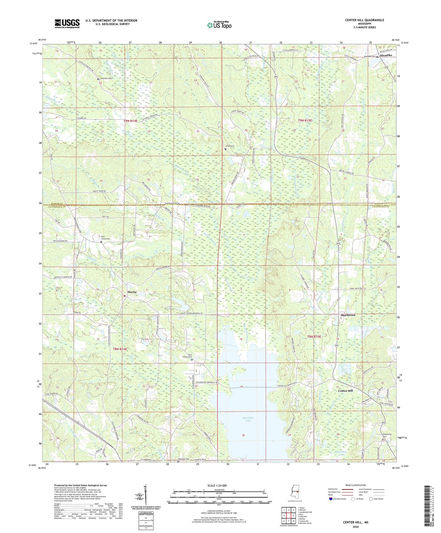
2024 topographic map quadrangle Center Hill in the state of Mississippi. Scale: 1:24000. Based on the newly updated USGS 7.5' US Topo map series, this map is in the following counties: Lauderdale, Kemper. The map contains contour data, water features, and other items you are used to seeing on USGS maps, but also has updated roads and other features. This is the next generation of topographic maps. Printed on high-quality waterproof paper with UV fade-resistant inks.
Quads adjacent to this one:
West: Post
Northwest: House
North: Moscow
Northeast: Lauderdale NW
East: Daleville
Southeast: Meridian North
South: Collinsville
Southwest: Duffee
This map covers the same area as the classic USGS quad with code o32088e7.
Contains the following named places: Bounds Pond Dam, Center Hill, Chickasawhay Creek, Chisholm Cemetery, Dripp Off School, Duluth Snowden Pond Dam, E T Brown Pond Dam, Fellowship Baptist Church, Fellowship Cemetery, First Baptist Church of Collinsville, Fort Stephens, Frazier Grove Church, Gin Creek, Hamrick Cemetery, Hodge Branch, Hopewell Church, House Creek, Houston Creek, J W Wilson Pond Dam, Klondike, Klondike Cemetery, Litchfield, Little Zion Church, Lower Store, M C Williams Pond Dam, Martha Cobb Pond Dam, Martin, Martin Volunteer Fire and Rescue Department, McDonalds Store, Mount Pleasant Church, Murry Rogers Catfish Ponds Dam, Oakdale Church, Okatibbee Lake, Okatibbee State Wildlife Area, Oktibbeha, Penders Creek, Pine Forest Baptist Church, Pine Forest Cemetery, Pine Grove Baptist Church, Pine Grove Cemetery, Pleasant Grove Church, R E Scruggs Pond Dam, Rushing Store, Russels Store, Shucktown, Smith Pond Dam, Tallachula Creek, Toles Branch, Tompeat Creek, Union Baptist Church, Union Cemetery, W O Wilkerson Pond Dam, White Branch