MyTopo
Tremont Mississippi US Topo Map
Couldn't load pickup availability
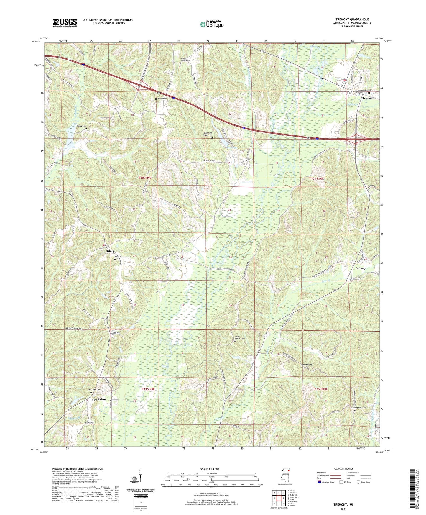
2024 topographic map quadrangle Tremont in the state of Mississippi. Scale: 1:24000. Based on the newly updated USGS 7.5' US Topo map series, this map is in the following counties: Itawamba. The map contains contour data, water features, and other items you are used to seeing on USGS maps, but also has updated roads and other features. This is the next generation of topographic maps. Printed on high-quality waterproof paper with UV fade-resistant inks.
Quads adjacent to this one:
West: Beans Ferry
Northwest: Fulton
North: Fulton SE
Northeast: Shottsville
East: Bexar
Southeast: Detroit
South: Turon
Southwest: Smithville
This map covers the same area as the classic USGS quad with code o34088b3.
Contains the following named places: Cadamy, Clover Ridge Cemetery, Cypress Creek, E L Clayton Lake Dam, Graball, Gum Creek, Hamptons, Hickory Creek, Hopewell Baptist Church, Hopewell Cemetery, Hopewell Lookout Tower, Johns Creek, Kennedy Cemetery, Kennedy Chapel, Lick Skillet Creek, Maxey Cemetery, Moore Cemetery, Morganton, Mount Moriah Cemetery, Mount Moriah Church, Mount Pisgah Baptist Church, New Hope Church, New Salem, New Salem Cemetery, Nita Lake, Nita Lake Dam, Old Mount Pisgah Cemetery, Otis, Reedsville, Russell Lake Dam, Stacy Russell Lake Dam, Supervisor District 4, Thompsons Store, Tilden, Tilden Cemetery, Tilden Church of Christ, Tilden Volunteer Fire Department, Town of Tremont, Tremont, Tremont Cemetery, Tremont Elementary School, Tremont First Baptist Church, Tremont High School, Tremont Methodist Church, Tremont Post Office, Tremont Volunteer Fire Department, Whitney