MyTopo
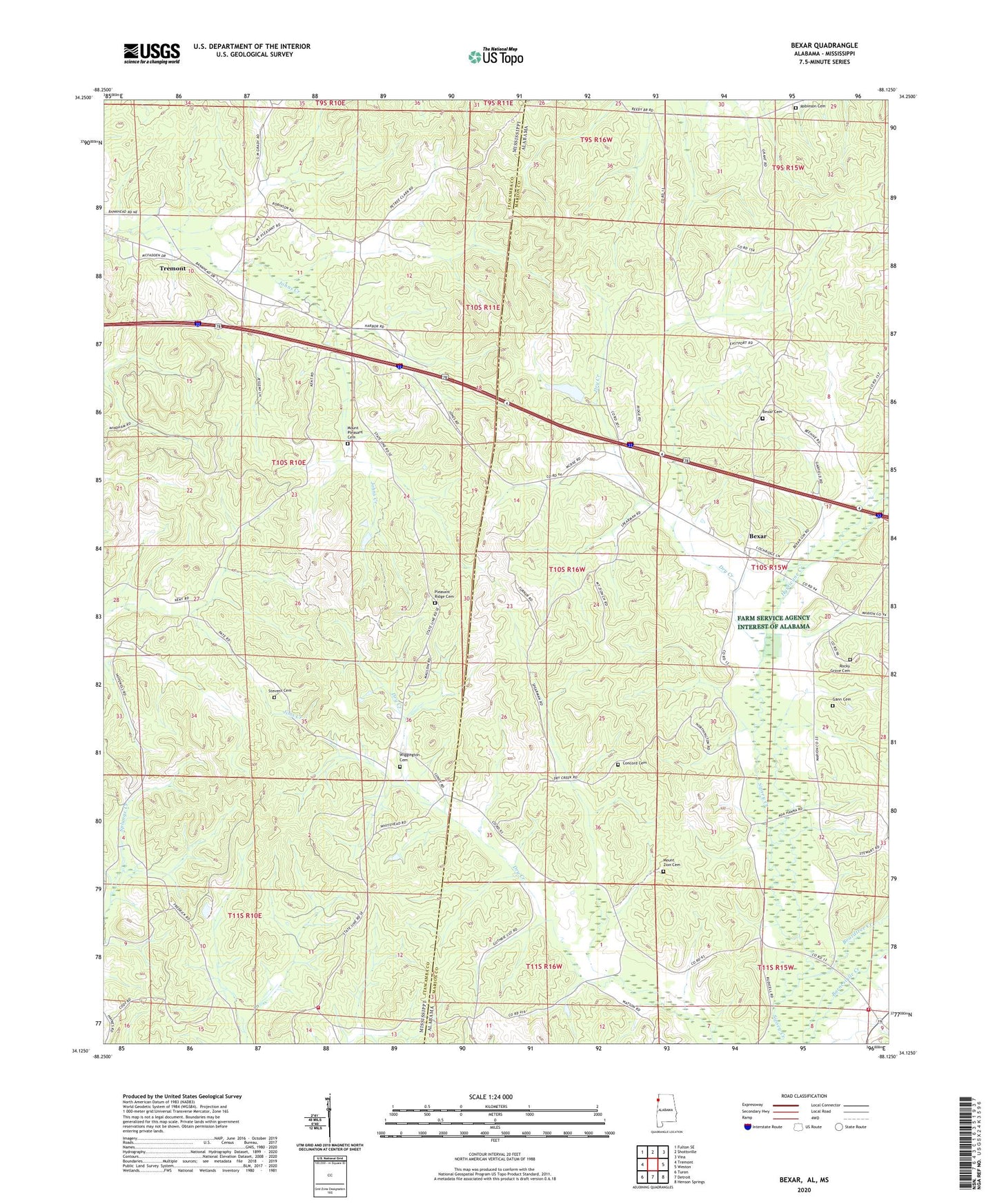
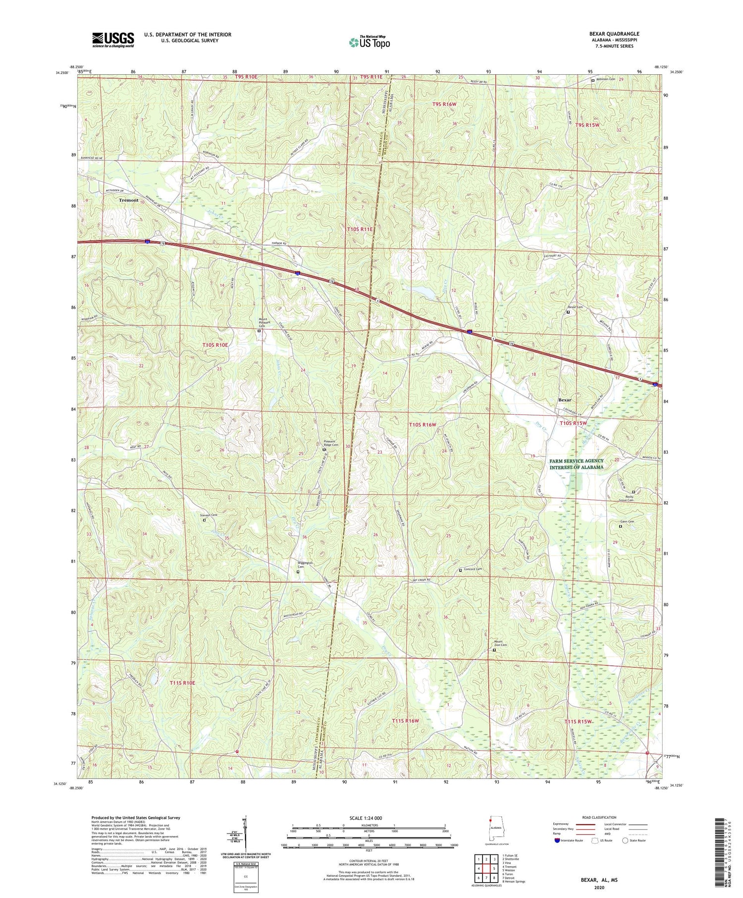
Bexar Alabama US Topo Map
Couldn't load pickup availability
2024 topographic map quadrangle Bexar in the states of Alabama, Mississippi. Scale: 1:24000. Based on the newly updated USGS 7.5' US Topo map series, this map is in the following counties: Marion, Itawamba. The map contains contour data, water features, and other items you are used to seeing on USGS maps, but also has updated roads and other features. This is the next generation of topographic maps. Printed on high-quality waterproof paper with UV fade-resistant inks.
Quads adjacent to this one:
West: Tremont
Northwest: Fulton SE
North: Shottsville
Northeast: Vina
East: Weston
Southeast: Henson Springs
South: Detroit
Southwest: Turon
Contains the following named places: Ada Hanna High School, Bexar, Bexar Cemetery, Bexar Church, Bexar United Methodist Church, Boardtree Creek, Byrd Volunteer Fire Department, Concord Cemetery, Dry Creek, Elksville, Elvis Spearman Church, Gann Cemetery, Guthrie Cut Church, Hurricane Creek, James Creek Church, Liberty Grove Volunteer Fire Department, McRae Dam, McRae Lake, Mount Pleasant Cemetery, Mount Pleasant Church, Mount Zion Cemetery, Piney Grove Church, Pleasant Ridge Cemetery, Pleasant Ridge Church, Robinson Cemetery, Rocky Grove Cemetery, Rocky Grove Missionary Baptist Church, Salem Church, Smith Temple Church, Stevens Cemetery, Wiggington Cemetery, ZIP Code: 38876