MyTopo
House Mississippi US Topo Map
Couldn't load pickup availability
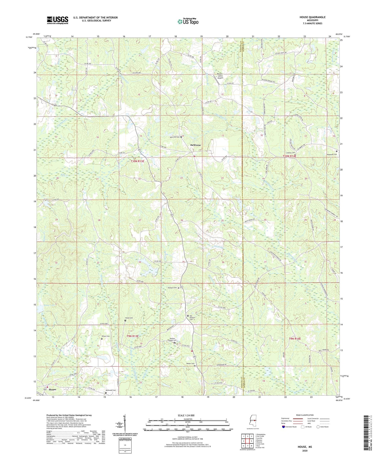
2024 topographic map quadrangle House in the state of Mississippi. Scale: 1:24000. Based on the newly updated USGS 7.5' US Topo map series, this map is in the following counties: Neshoba, Kemper. The map contains contour data, water features, and other items you are used to seeing on USGS maps, but also has updated roads and other features. This is the next generation of topographic maps. Printed on high-quality waterproof paper with UV fade-resistant inks.
Quads adjacent to this one:
West: Deemer
Northwest: Philadelphia
North: Owl Creek
Northeast: Lynville
East: Moscow
Southeast: Center Hill
South: Post
Southwest: Union East
This map covers the same area as the classic USGS quad with code o32088f8.
Contains the following named places: Center Ridge Church, Cushtusha, DeWeese, Dry Creek, Eason Branch, East Neshoba School, East Neshoba Volunteer Fire Department Station 3, Emoqualosha Plantation, Friendship Church, Harmony Church, Herbert, Herbert Cemetery, Herbert Church, Hester Cemetery, Hester Chapel, Hester Lake Dam, Hesters Chapel Cemetery, Hopewell Cemetery, Hopewell Church, House, House Cemetery, House Lake, House Volunteer Fire Department, House Volunteer Fire Department Station 2, Java, Liberty Baptist Church, Liberty Cemetery, Mars Hill Cemetery, Mars Hill Church, McClain Chapel, McDonald Cemetery, McLain - Calico Airport, Mount Carmel Church, New Hope Church, Old Herbert Cemetery, Persimmon Chapel, Smith Branch, Smith Chapel, Spanish Oak Church, Spinks, Tucker Branch, Union Sportsman Club Lake Dam, West Imongalasha, Wilson Branch, Wilson Cemetery, Yazoo, Yazoo Plantation