MyTopo
McCall Creek Mississippi US Topo Map
Couldn't load pickup availability
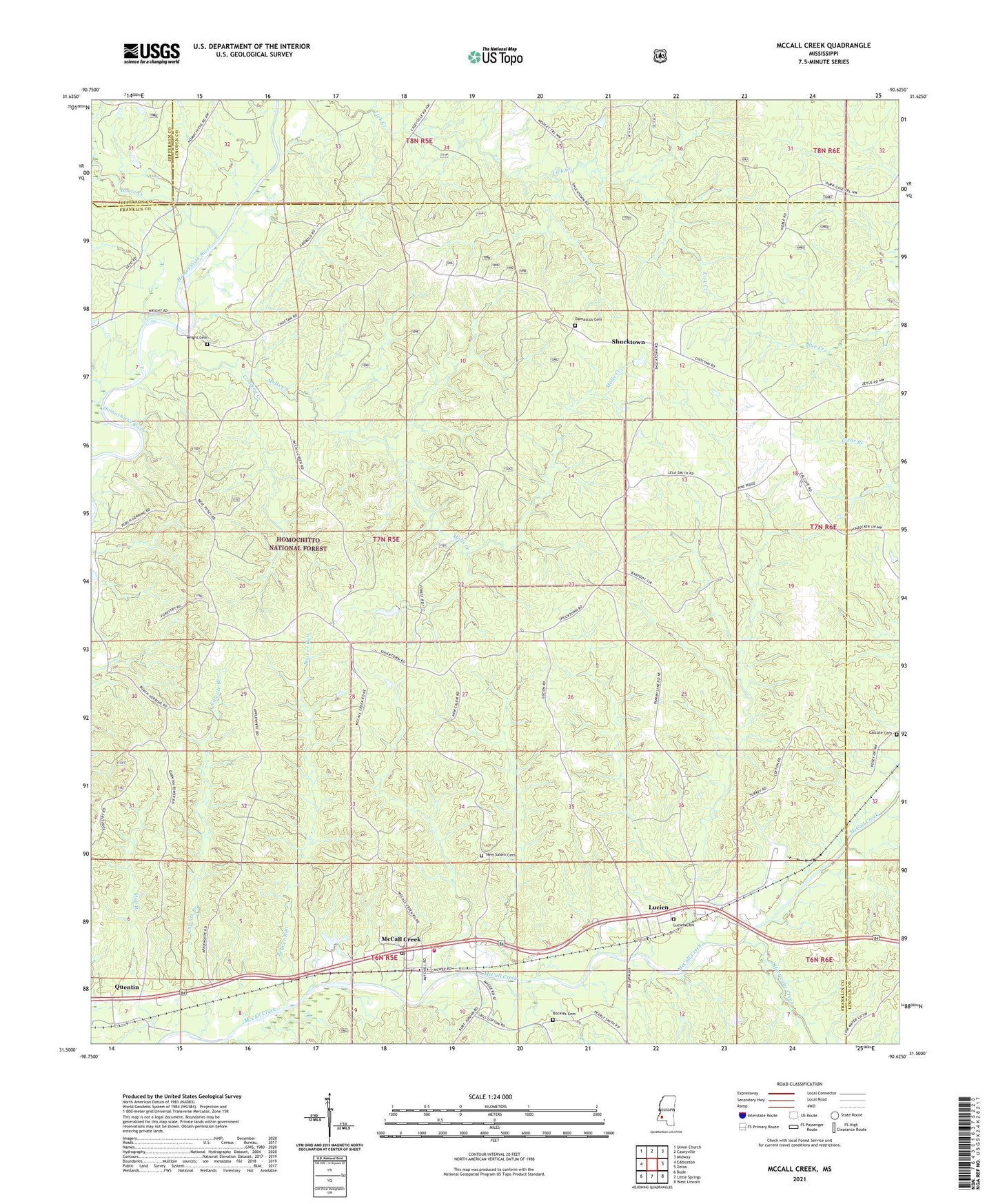
2021 topographic map quadrangle McCall Creek in the state of Mississippi. Scale: 1:24000. Based on the newly updated USGS 7.5' US Topo map series, this map is in the following counties: Franklin, Lincoln, Jefferson. The map contains contour data, water features, and other items you are used to seeing on USGS maps, but also has updated roads and other features. This is the next generation of topographic maps. Printed on high-quality waterproof paper with UV fade-resistant inks.
Quads adjacent to this one:
West: Eddiceton
Northwest: Union Church
North: Caseyville
Northeast: Midway
East: Zetus
Southeast: West Lincoln
South: Little Springs
Southwest: Bude
Contains the following named places: Beaver Run, Bethel Church, Bockles Cemetery, Calcote Branch, Calcote Cemetery, Celco, Cool Spring Church, Crooked Creek, Damascus Baptist Church, Damascus Cemetery, East Franklin Rural Volunteer Fire Department, Gayle Evans Lake Dam, Horse Creek, Hurricane Creek, Kennolia, Lucien, Lucien Cemetery, Macedonia Church, McCall Creek, McCall Creek Post Office, Molls Creek, New Salem Baptist Church, New Salem Cemetery, Quentin, Quentin Lookout Tower, Rights Ford, Shucktown, Supervisor District 4, Wright Cemetery, Wright Church, ZIP Code: 39647