MyTopo
Montpelier Mississippi US Topo Map
Couldn't load pickup availability
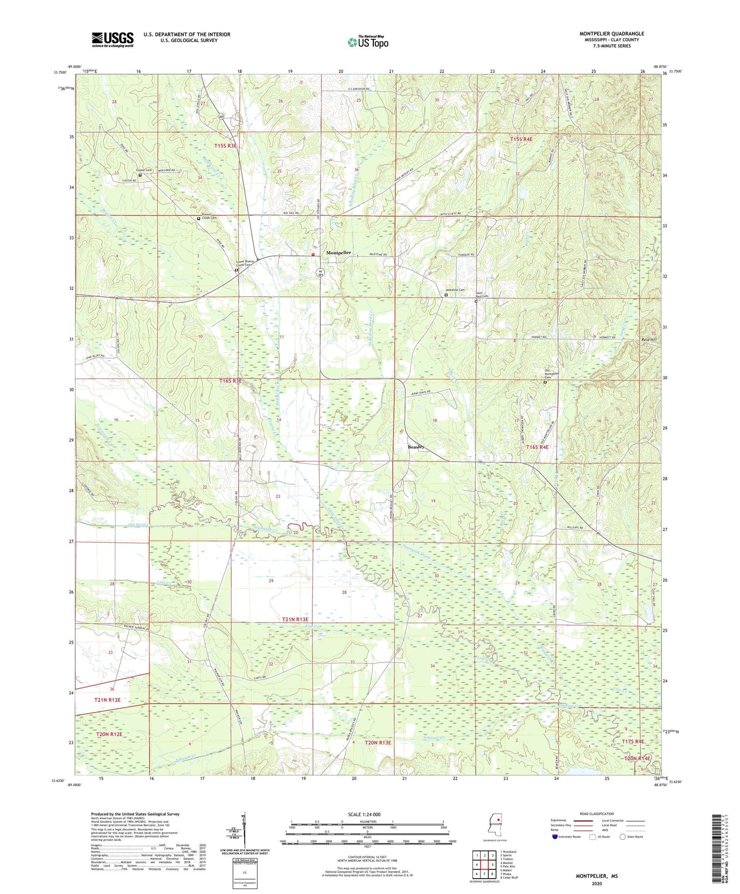
2020 topographic map quadrangle Montpelier in the state of Mississippi. Scale: 1:24000. Based on the newly updated USGS 7.5' US Topo map series, this map is in the following counties: Clay. The map contains contour data, water features, and other items you are used to seeing on USGS maps, but also has updated roads and other features. This is the next generation of topographic maps. Printed on high-quality waterproof paper with UV fade-resistant inks.
Quads adjacent to this one:
West: Mantee
Northwest: Woodland
North: Sparta
Northeast: Trebloc
East: Palo Alto
Southeast: Cedar Bluff
South: Pheba
Southwest: Maben
Contains the following named places: Beasley, Brewer Lake, Brewer Lake Dam, Buck Creek, Cairo, Cairo-Cumberland Church, Clarks Chapel, Clay County Volunteer Fire Department Unit 300 Montpelier, Cousin Cemetery, Johnson Creek, Lighthouse Church, Little Cane Creek, Lower Prairie Creek Cemetery, Lower Prairie Creek Missionary Baptist Church, Montpelier, Montpelier Baptist Church, Montpelier Post Office, North Canal, Old Field Creek, Old Montpelier Baptist Church, Old Montpelier Cemetery, Palestine, Palestine Cemetery, Palestine Church, Pine Grove Church, Prairie Creek, Prairie Creek Cemetery, Robinson Chapel, Saint Paul Cemetery, Saint Paul Church, Sand Creek, Sewayiah Creek, South Canal, Standing Reed Creek, Supervisor District 5, Upper Prairie Creek Missionary Baptist Church, Walkers Church, Walkers Gin, Walkers Lake Dam, West Clay County Elementary School, West Clay County High School