MyTopo
Palo Alto Mississippi US Topo Map
Couldn't load pickup availability
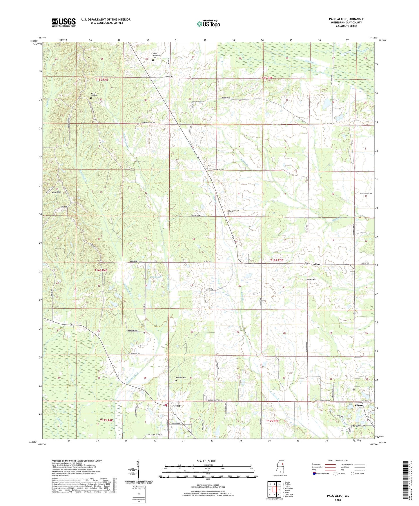
2024 topographic map quadrangle Palo Alto in the state of Mississippi. Scale: 1:24000. Based on the newly updated USGS 7.5' US Topo map series, this map is in the following counties: Clay. The map contains contour data, water features, and other items you are used to seeing on USGS maps, but also has updated roads and other features. This is the next generation of topographic maps. Printed on high-quality waterproof paper with UV fade-resistant inks.
Quads adjacent to this one:
West: Montpelier
Northwest: Sparta
North: Trebloc
Northeast: Prairie
East: Muldon
Southeast: West Point
South: Cedar Bluff
Southwest: Pheba
This map covers the same area as the classic USGS quad with code o33088f7.
Contains the following named places: Abbott, Abbott Cemetery, Abbott Christian Church, Abbott Missionary Baptist Church, Abbott School, Big Springs, Bowman Lake Dam, Chandler Cemetery, Chandler Grove Church, Clay County, Clay County Volunteer Fire Department Unit 600 Central, Darrel Thompson Lake Dam, Deans Lake, Deans Lake Dam, Dexter Lake Dam, Elliot Pond Dam, Enon Church, Griffith, Griffith Christian Church, Hopewell, Hopewell Baptist Church, Hopewell School, Johnson Church, Palo Alto, Palo Alto Cemetery, Palo Alto Missionary Baptist Church, Reid Hill, Rocky Hill, Rocky Hill Cemetery, Rocky Hill Church, Saint Robertson Cemetery, Saint Robertson Church, Shady Grove Church, Shaffer Cemetery, Siloam, Siloam Baptist Church, Siloam Methodist Church, Siloam School, Supervisor District 3, Supervisor District 4, Watkins Cemetery, Woodruff Creek, Yatsey Chapel, ZIP Code: 39741